.
NOTICE .. Any duplication, electronic or otherwise, of the images at this Website without my expressed permission is a copyright violation, and I will treat it as such. Do us both a favor and ask me for permission before using any of the images herein ... you can e-mail me at cdoswell@earthlink.net.
NOTICE .. All images I show on my Web pages have been scanned from original slides, with some digital enhancement (touch-ups of dirt on the slides when scanned, and some enhancement of the original scanned images to make them look more like the original slides). I do not alter my images digitally to put in things that were not originally in the image or remove things that were originally in the image, and I do not make digital composites. I am personally opposed to such image manipulations unless they are admitted to clearly and obviously. Frame captures require some significant enhancement to get the color and contrast back into them, so these have all been manipulated ... but again, this is done primarily to recreate the look of the video in the frame captures.
Route notation: "USXX" denotes US highway XX, "I-xx" denotes Interstate highway xx, "SSxxx" denotes state (SS) highway xxx, "FMXX" in TX denotes farm-to-market highway XX. Wherever possible, cities having National Weather Service offices are identified with the appropriate 3-letter identifier.
Route: Can't recall the details
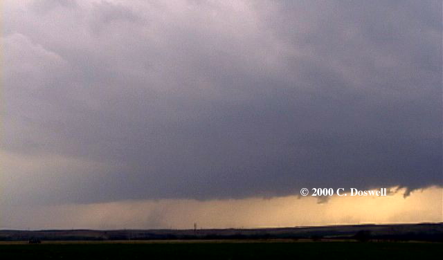
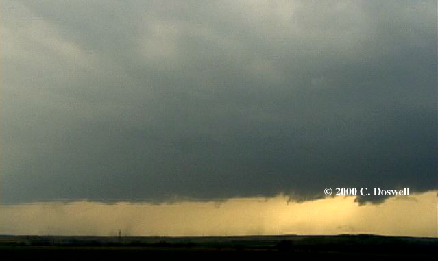
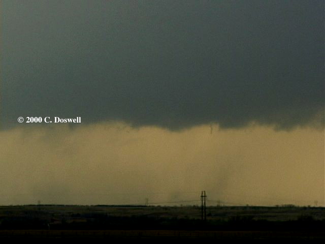
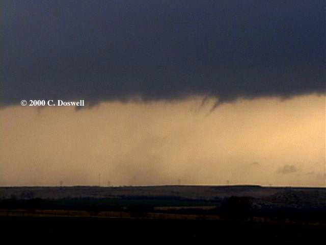
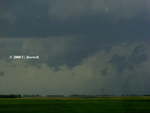
John Monteverdi was in town and we decided to chase this day. Early on, there were lots of towering cu, but it was hard to decide which to chase. We watched one on the west side of Lawton, OK (I think) and chased it ... movement was basically northward as it slowly increased in intensity. It might well have been weakly rotating, but ... after negotiating some road problems, we found it was moving northwestward! Then it merged with a murky squall line, so we blew it off. The radio was blaring some warnings back south of us, so we bactracked that way and intersected the rapidly advancing squall line on US62 (I think it was west of Lawton). From there, we could see various dust blobs that looked like gustnadoes, and many little spiky things that at least some folks might have called funnel clouds ... e.g., here and here. There certainly didn't appear to be much organized rotation, although we thought one cell might have had some weak rotation as it crossed US62, headed north-northeast. After seeing some more spiky things that might have been funnels but probably weren't, we gave up and returned to Norman. A fun chase, but without much in the way of results.
Route: Left OUN I-35 to US60, west to 2 west of junction with US60/64, then back east, then south on US64 to END to Okarche, then southeast on OK3 to OK4, then south on OK4 to I40, then east to I44/240, south, then east to I-35, back to OUN.
A busted day, without images. Went north to the boundary but the cap was too strong. Ran into Cloud 9 tours on I-35 and commiserated with Dave Gold and Gene Moore. High temperatures pushed surface low southward, backing winds to too much northerly component. Boundary pushed south and so did we. Saw storms late in the day to our south but chose not to go after them as they were apparently pretty distant and it was getting late in the day. Elected to try again tomorrow. A sorry start on the anniversary of Union City.
Route: Left OUN on I-35 north to I-44/240 to I-40, west to AMA, on to Adrian, then south on FM 214, turned west, still on FM214, continued west on dirt road for about 6 miles, then back to FM214, east and then north to FM2587, then north on US385 to Vega, then east on I-40 to AMA.
Bad timing and a bad choice. Intercepted a supercell coming out of NM but into Deaf Smith county and then into Oldham county ... almost non-existent road choices. It was a disorganized mess by the time we got a good look at it. Very bad visibilities ahead of the storm. As it passed to the northwest of AMA we blew off the day. Apparently, tornadic storms fired behind this, and by the time we heard about them, we were in the motel and it was very close to dark ... we gave up too soon, today.
Route: Left AMA on US66 northeast to Pampa, then north on TX70 to Perryton, then north on US83 to US56 through Sublette and into DDC ... then west on US50 to Ingalls, KS, then south on Ingalls Rd to Co. Rd N, then west ot Plymell Rd to Plymell, then north on US83 to GCK, then east-southeast on US 50 to DDC.
It seems we were way outta position for anything ... ended up in DDC on the hope of something refiring in the recovering airmass, close to better winds aloft. Instead, we were nowhere re storms! Sat in the motel for awhile, watching TWC with tornado watches in OK and TX ... finally saw a storm developing west of GCK so we went after it. It looked sort of interesting as we approached it, but it gusted out as we got close, near GCK. Bagged it and went back to DDC for the night.
Route: Left DDC on US50 to GCK, then north on US83 to Oakley, KS, then west on I-70 to GLD, then north on KS27 to US36, then east to KS161, north to NE where the road becomes NE61, continuing north to IML and on to I-80 at Ogallala NE, then east to LBF.
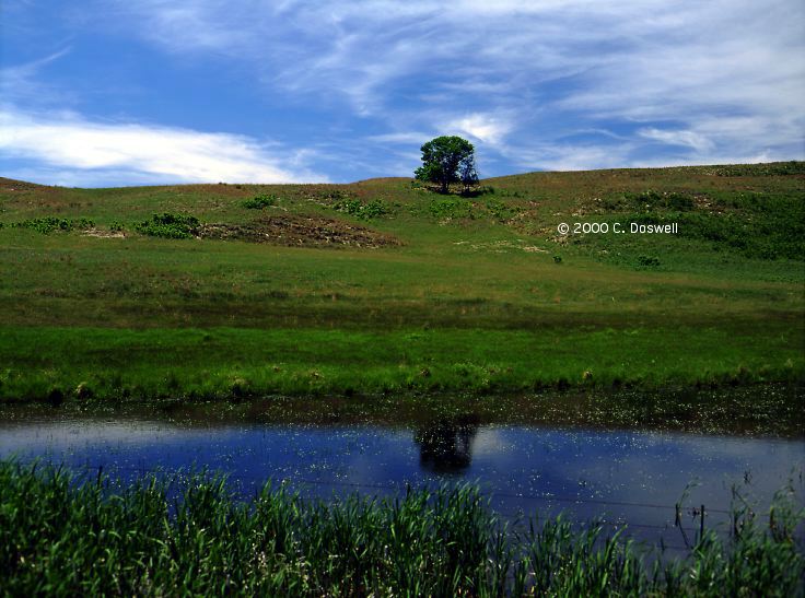
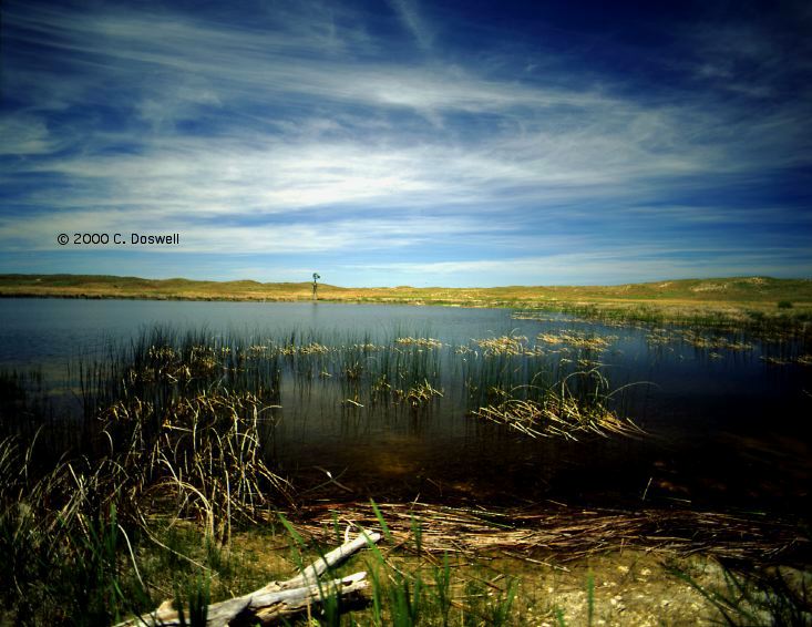
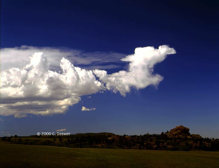
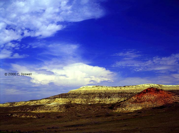
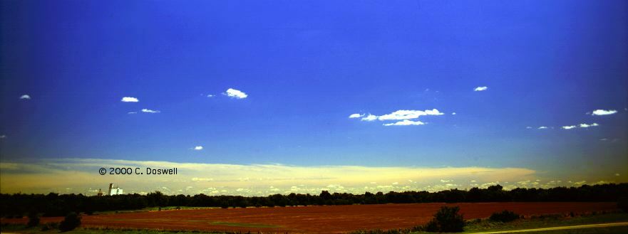
Basically, a repositioning day, hoping for a long shot in the northern Plains. Some nice country in northwestern KS and southwestern NE ... took a few artsy shots on the way.
Route: Left LBF on US83, north to near VTN, wandered down Spur 16B for about 15 miles, then back toward VTN and a bit west to Nenzel on US20, then back to VTN.
Another "long shot hope" day that produced some weak showers in southwestern NE that we could see from a distance .. a few distant shots at sundown. Enjoyed the Sandhills area ... some scenic shots in and around the Sandhills. Hoping for a better day tomorrow.
Route: Left VTN going west on US20, to Crawford, NE, then south on NE2/71, turning east on NE2 to to Hemingford, NE, then southeast to AIA, then east to Hyannis, NE, then south on NE61 to Arthur, then east on NE97 to Tryon and a few miles east before turning south to LBF, then east-southeast on US30 to Brady, then back to LBF
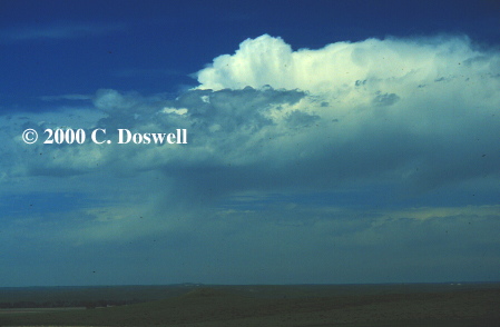
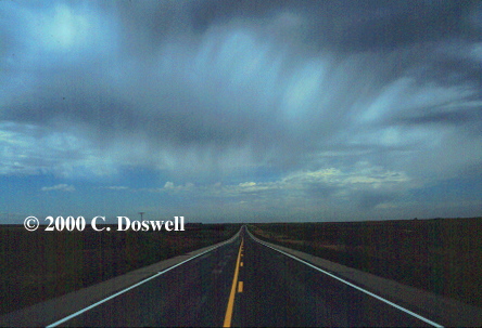
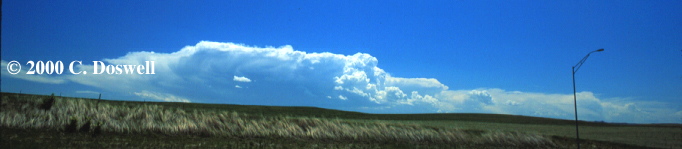
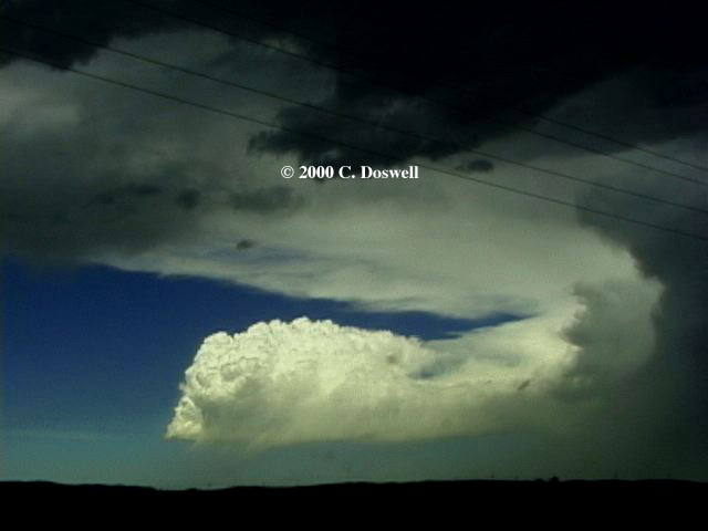
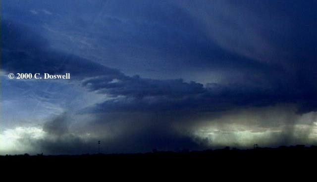
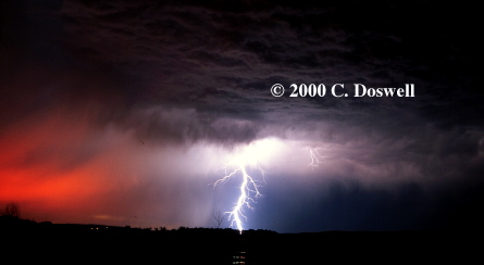
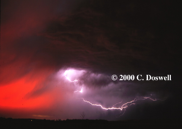
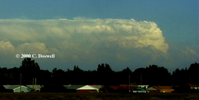
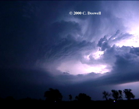
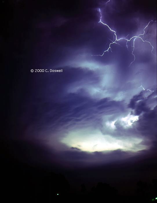
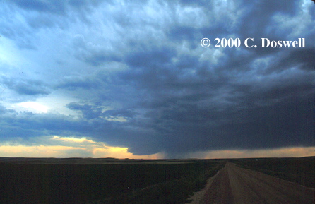
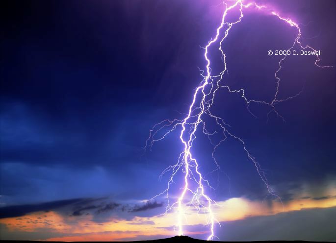
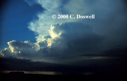
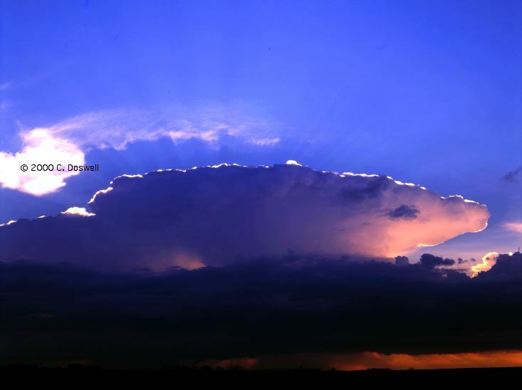
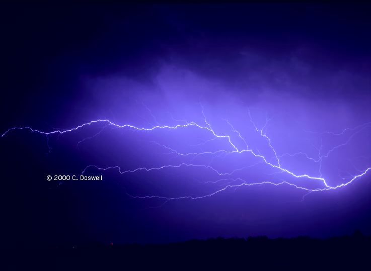
Now today was more like it! The day started with some interest. On the way west, we saw some fuzzballs that wound up producing some virga and light rain. Then, we reached our intercept point (Crawford, NE) and waited. We caught this event from where it started, south and west of Crawford, NE. Since we were coming from the north, we saw the left-movers first, first without seeing under the base, and then getting a nice clear view. All of the bases were high and the storm was pretty disorganized early, when we stopped in AIA. Lots of microbursts under the anvil ... a harbinger of behavior to come. We also saw a weird storm develop on the left front side of our storm, under the anvil. It eventually dissipated. Gradually, our target storm cranked its way upward in intensity. Ran into the CoD gang in their two vans on our way east-southeast. Saw a few other chasers on the road (maybe Al M.?) and also stopped and talked with Mike (and Erin) Foster (later, south of Tryon, NE, looking west, at a time when the storm got another good look to it). Finally, it began to get a clear look of rotation, but when we saw it during what might have been its best look (south of Hyannis, NE, looking west), we were ahead (east) of it, but in 50-60 mph north winds ... during this time, our car thermometer was in the low 80s (F)!! This flow (which I don't pretend to understand) probably precluded any tornadoes. We stayed ahead of the southermost storm in what was turning into a bow echo through LBF. There were tornado warnings as the storm slammed into LBF, but it was clear that people were seeing dust columns being kicked up, not tornadoes. On the way back to LBF for the night, we caught a great sunset and some wild lightning (between Brady and Maxwell) .. here and here. All in all, a pretty decent day, but well short of a tornado ... all the mesos apparently were undercut, even though they were clearly rotating cyclonically above cloud base. Maybe tomorrow?
Route: Left LBF on US30, west to US385, north to Bridgport, NE, then south and west on NE88, to NE71, to BFF.
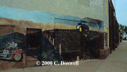
Cold air pushing southward, westerlies far away from any instability at the surface, enormous capping ... all factors leading to a dead day. Drifted to BFF via a scenic route. Note the mural we saw in Chappell (as I recall) ... see the upper right corner.
Route: Left BFF on US26 west to Torrington, WY, then south on US85 to I25, south to CYS, east on I-80 to Kimball, NE, then south on NE/CO71 to Stoneham, CO, then back north on CO/NE71 to Kimball, NE, west on I-80 to CYS.
Pretty much a bust on yet another "long shot". Strong capping held down the activity until after we had gotten a motel room in CYS ... looked out from the balcony and saw storms going up to the southeast, so we went after them, but they fizzled right at sunset. Saw Al M. at the CYS office ... it wasn't him we saw on the 29th.
Route: Left CYS on I-80 east to Kimball, NE, south on NE/CO71 to LIC, then west on I-70 to CO86, west to Castle Rock, CO.
Yet another dead day. Met John Monteverdi in LIC. Nice drive from LIC to Castle Rock. If moisture returns, the upslope might be active tomorrow in southern CO.
Route: Left Castle Rock on I-25 north to DEN, east and then north on I-225 to I-70, east to Bennett, CO, then north on CO79 to Prospect Valley, CO, then east on CO52, and immediately north to I-76, northeast to I80, east to LBF.
Another busted day. Heard talk of "landspouts" (ugh!) on DEN's NWR so we hung around there, including a stop at Cherry Creek State Park (nice) until it was pretty obvious that there would be no convection on the putative DCVZ, then blasted northeast to be in position for action in NE/SD. Always, hope for tomorrow ... this has not been a productive year. Almost all the "long shots" are resulting in nothing!
Route: Left LBF on US83 north to Mission, SD, then east on SD44 to US183, then north to Presho, SD, then east on I90 to east of Kimball, SD, then south on SD45 to Platte, SD, then east on SD44 to SD50, then south Lake Andes, then south on US281 to O'Neill, NE, then east on "old hwy 108" to Spur45A, south to US20, east on US20 (although it was "closed" to all but "local" traffic) to near Orchard, NE, then south on unnamed county road to US275, east to OFK.
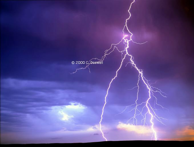
Quite a wild day. We overshot to the north in search of the warm front with its backed winds, had to backtrack south when we got overrun by cool north winds. Storms began to fire late in southeastern SD, apparently on the leading edge of the cool north winds. They struggled for quite awhile against the shear, but finally got cooking. I've always wondered about the storms that fire on the warm advection wing ahead of a steep lapse rate (cap) intrusion. These began to propagate strongly southward, with net motion to the southeast. There might have been a skinny rope tornado shortly after the storm crossed the river (ahead of us) but we couldn't be sure and we got no images of it. Our storm had a nice look after we crossed the river, so we stopped briefly to get some shots before we charged on southward. There was a lead, rotating storm that lots of other people were on (like Al M. and Cloud 9), with our storm behind it, which came close to producing tornadoes (there were debris whirls and rapid cloud motion under the base) when it was east of Spencer, NE. We managed to stay with the lead storm as it was fairly slow-moving, in spite of some road problems with US20 southeast of O'Neill, NE. As it got darker, we got on US275 which allowed us to stay with it. Another supercell fired in its wake. We stopped several times for pictures (tough contrast so they don't scan well) and finally sat near Meadow Grove, NE and I shot video and medium format lightning. As the trailing supercell came toward us, it had a terrific beaver's tail, and lots of anvil "zits" and a few CGs. Numerous tornadoes were spotted in our vicinity there, but we never saw any of them ... they might be legit reports, but ... . We got into OFK late and the storms arrived there about the same time, finally moving through and off to the southeast, with lots of anvil "zits" ... not too many CGs. In spite of having misjudged the forecast, we managed to get on what were apparently the "storms of the day" in northeastern NE ... a long, exhausting chase.
Route: Left OFK on US83 south to GRI, US30 to I-80, west to CYS.
Repositioning day. Saw lots of "horseshoe" vortices on our way to CYS, but they turned out to be non-portending.
Route: Left CYS on I-80 west for about 32 miles, then back east to Kimball, NE, then north on NE71 to BFF.
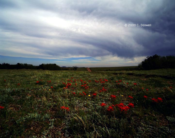
Another nothing day. Some weak storms developed on the Big Horn Mountains to the west of CYS, so we went out and watched them for a while. Did some artsy stuff in a park near the Interstate, with clouds and wildflowers, then hooked it to BFF to get in position for what we hope will be a better day tomorrow. Ran into Al M. in CYS and he's been chasing with us.
Route: Left BFF on NE71 south to CO14, east to Sterling, CO, northeast on I-76 to I-80 to LBF.
Strange day. Lots of high-based convection over the mountains that drifted over the plains. In northeast CO, we experienced downdraft air at 97/-5 (3 percent RH!!) west of Sterling ... according to John's hand-held gadget. Decided to drift back to NE in order to get in position for tomorrow. Stopped near Ovid, CO to watch what appeared to be the northern "bookend" on a short squall line. Saw several funnels with this, and lots of neat features showing the horizontal vortex rolls and how they were being pulled upward at the end of the line. However, chances of a tornado were basically nil. Like Cub fans, we're still hopeful for tomorrow, as usual.
Route: Left LBF on US83 north to Murdo, SD, west on I-90 to Wall, SD.
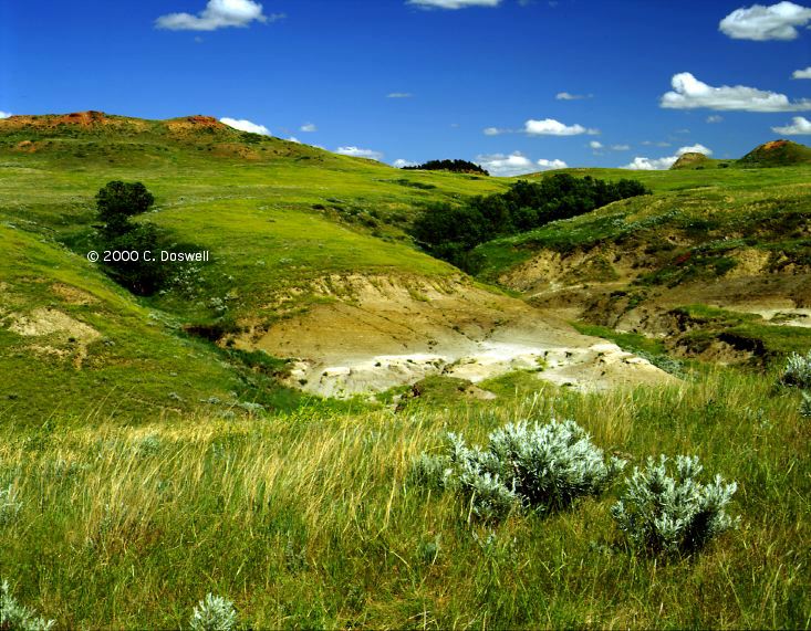
A repositioning day, with a long shot of something near RAP ... that didn't pan out. Did a brief tour through the SD Badlands.
Route: Left Wall, SD on I-90 west to Spearfish, SD, then north on US85 to Bowman, ND, then west on US12 to Rhame, ND, then south on Rhame Road, to SD733/Ladner Road, west for 1.5 miles, then back to Cave Hills Road, south to Buffalo, then north on US85 to Bowman, ND, then west on US12 to Baker, MT, then north on MT7 to Wibaux, then east on I-94 to Beach, ND.
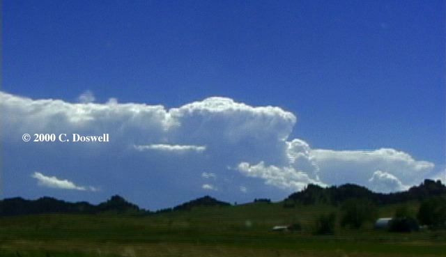
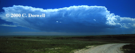
Interesting day. After much concern for storms developing near RAP, we proceeded into Bownan, ND, and then wandered back into extreme northwestern SD, where we found a supercell. It looked really good for awhile, but it was apparently LP in character and gradually dissipated in the usual "ever-diminishing updraft base" style so characteristic of LP supercells, so we started off to the southeast but without much hope of seeing something. Al called his office via cell phone and got a report from FTW to the effect there was a good storm near Miles City, MT, so we roared off in that direction. As we got into MT, however, it was pretty clear that the storms were NOT moving eastward or southeastward, so they were NOT supercells. John M. decided to leave us to get ready to go back home. We then found some great high-based lightning storms in eastern MT near and after sunset, which put on quite a show.
Route: Left Beach, ND on I-94 east to T.R. National Park, continued east on I-94 to DIK, then south on ND22 to US12, then west to Bowman, ND.
A lazy, photographic day. Spent most of it doing photography, first of a high-based morning storm, then in T.R. N.P. (the South Unit). Then we finally decided to go south after some storms we could see distant ... I got caught in a speed trap on ND22 (at New England, ND), for doing 74 in a 65 zone (72 on my speedo), but the fine was a measly $23! We were in north winds all day, and it was pretty cool. At the end of the day, we saw some storms coming at us and made a try for some lightning at a neat scene ... but it wasn't to be. My original notion to go south got forgotten during the photography ... Bill Reid posted that there were at least supercells down by Buffalo, SD (!), near where we saw the supercell yesterday [see here for Greg Thompson's images of what we missed]. Western ND is pretty gorgeous country ... in fact, from the NE Panhandle north is some pretty damned interesting and worthwhile scenery.
Route: Left Bowman, ND west on US12 to Rhame, ND, then south on Rhame Road, to SD733/Ladner Road, to Cave Hills Road, south to Buffalo, then south on US85 to SD168, then east to SD79, south to Sturgis, SD, then south and east on I-90 to Wall, SD.
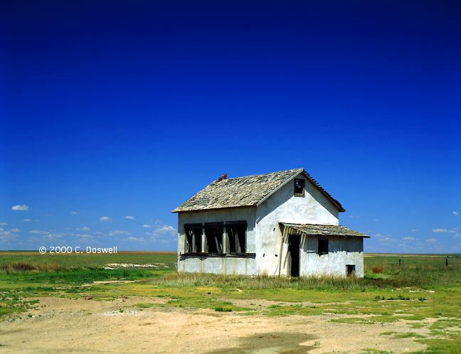
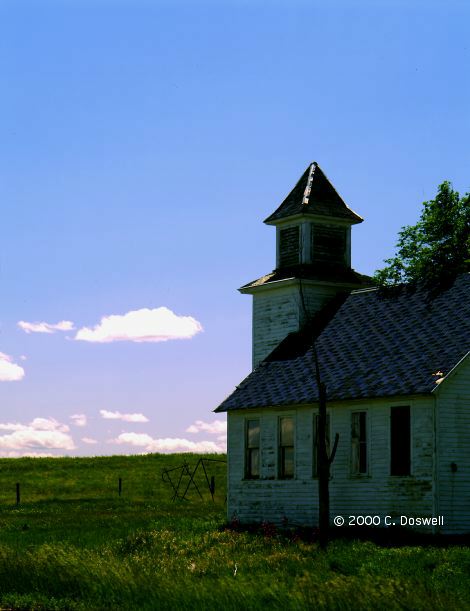
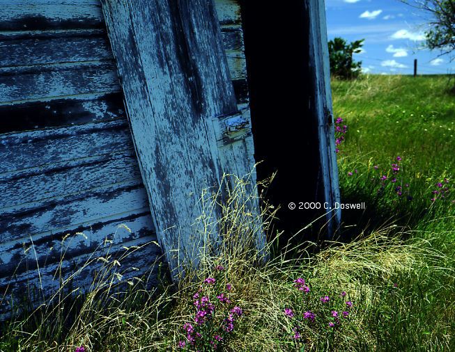
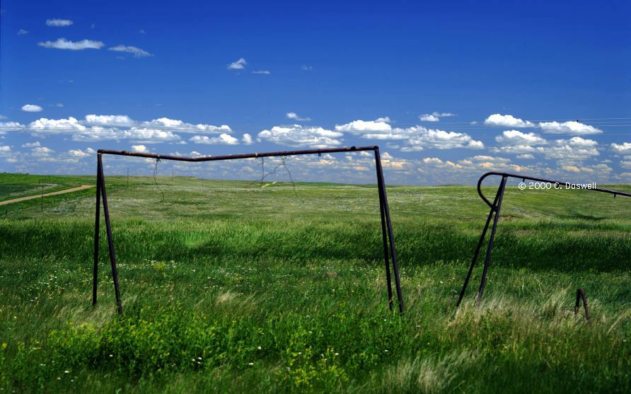
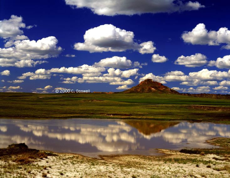
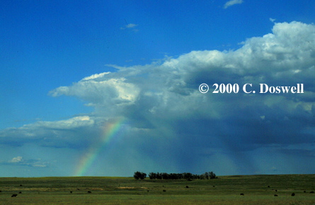
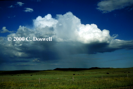
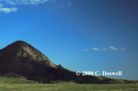
Another day of scenic photography. Followed our route south from Rhame, SD of 08 June, this time to capture the scenery: interesting churches, an abandoned schoolhouse, an old outbuilding (not an outhouse), some rather weather-beaten swings, a stock pond, some nice hillsides, etc. This route through the Cave Hills is pretty special. We even caught a rainbow from one fuzzball, a virga shaft from another, and a high-based, low-topped Cb that fired on Bear Butte, near Sturgis. There were some Kelvin-Helmholtz billows, too. A nice day photographically, but time is running out for tornadoes ...
Route: Left Wall, SD on I-90 east to Kadoka, south on SD73 to US18, continued south on unnumbered country road to US20, west on US20 to Gordon, NE, north on NE27 to US18, north on unnumbered country road to Porcupine, SD, then northwest on BIA23 to US44, east on US44 to Badlands Park.
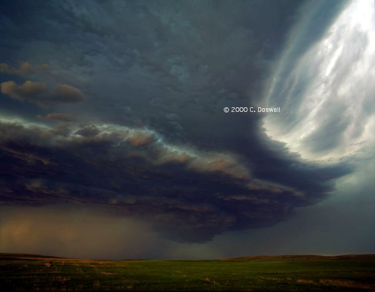
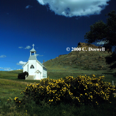
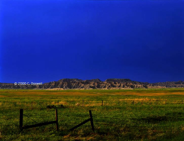
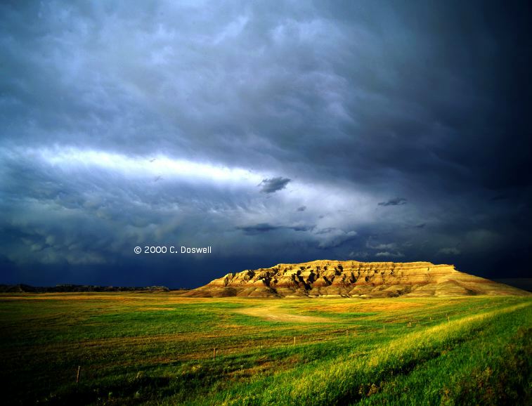
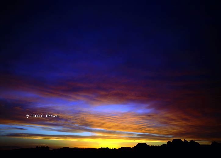
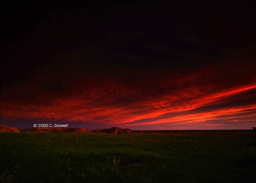
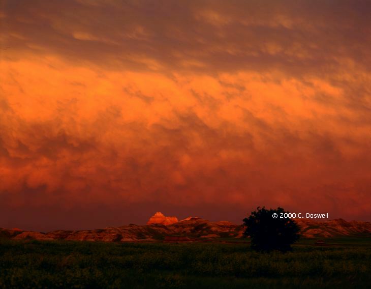
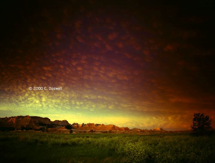
Frustrating day ... after much indecision, we went south to convective system that had developed overnight in NE that was continuing to fire. By the time we got near it, it had a good look for awhile, including possible supercells, but it fizzled near VTN. Then, we went west, hoping to see something interacting with the boundary laid down by the earlier storms ... but the storms that went up on the old boundary were pretty linear, so we went north. Had some road problems in the Indian Reservation but finally emerged west of the Badlands NP. Got some pretty decent images of the storms in the evening with the Badlands in the foreground, here and here. Camped in the park, and got some terrific sunset images, here and here, with light on the formations and on the underside of the anvil, including mammatus.
Route: Left Badlands NP on US44 to Cactus Flat, then west on I-90 to Sturgis, ND, north on SD79 to SD168 west to US85, then north to I-94 at Belfield, ND. Continued east on I-94 to JMS, north on ND20 to ND200, east to Mayville, ND.
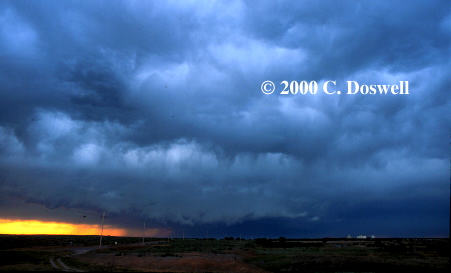
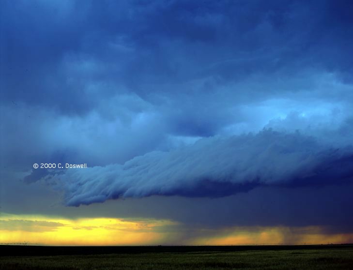
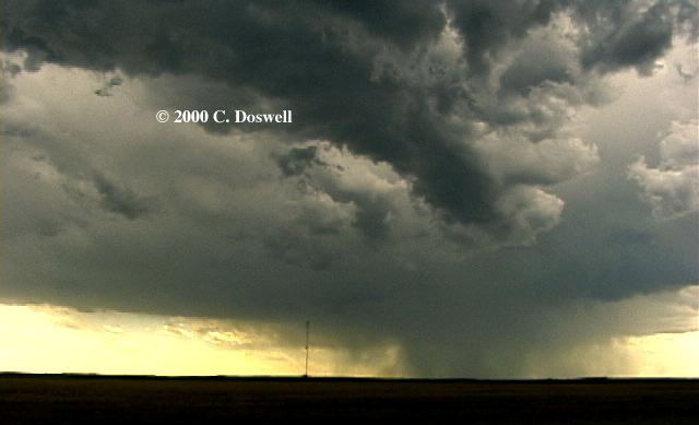
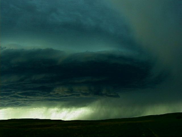
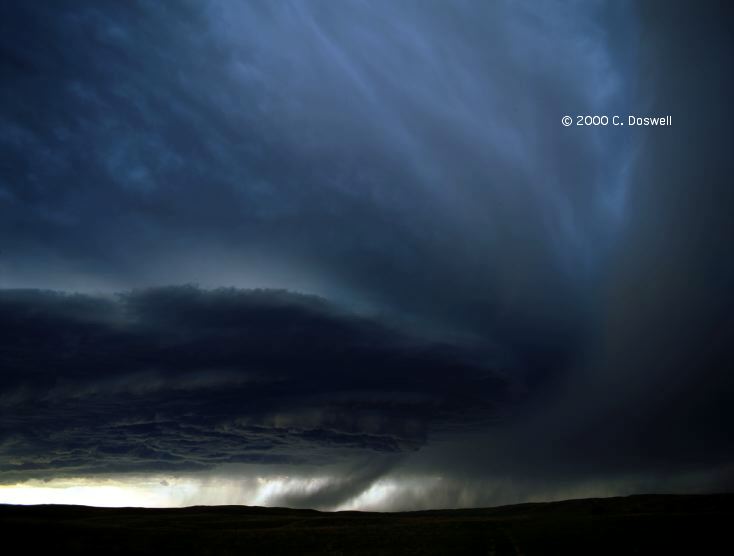
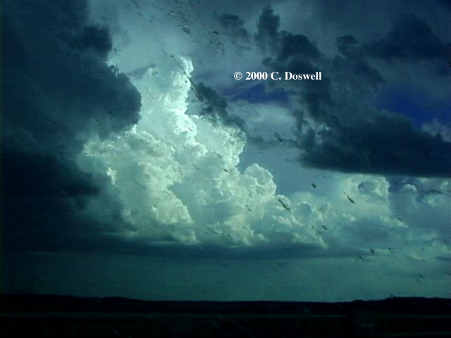
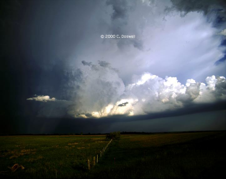
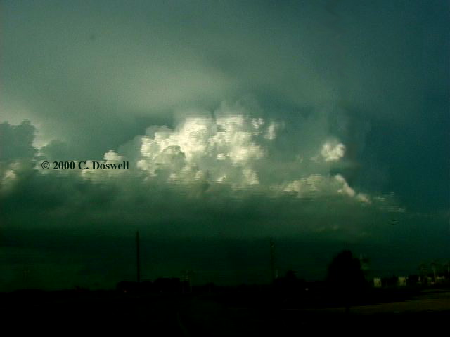
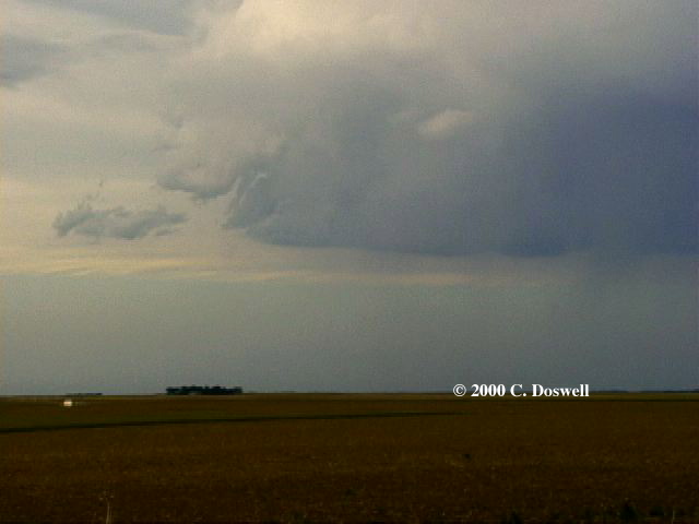
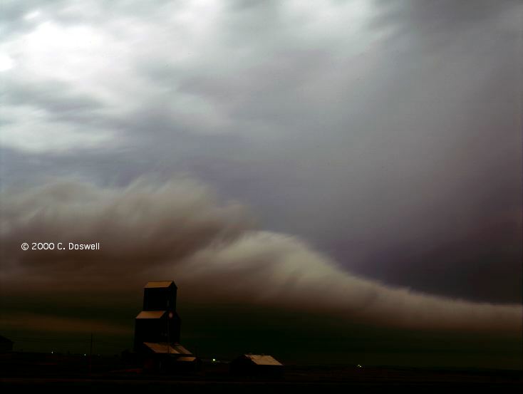
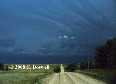
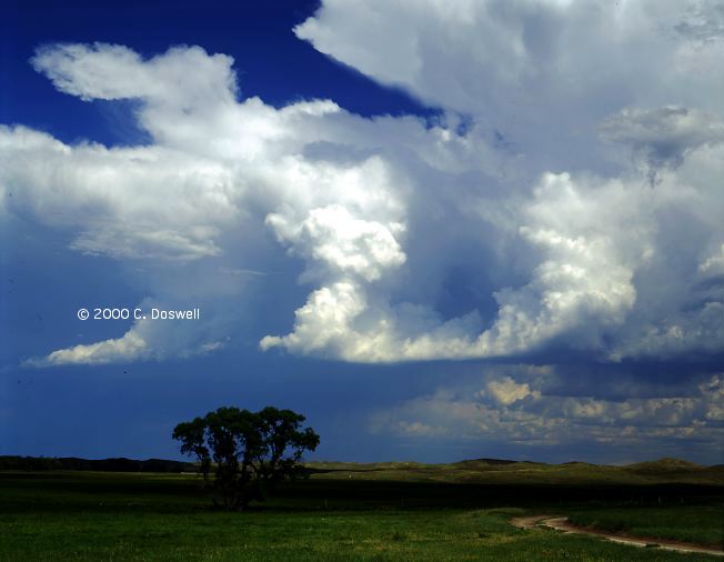
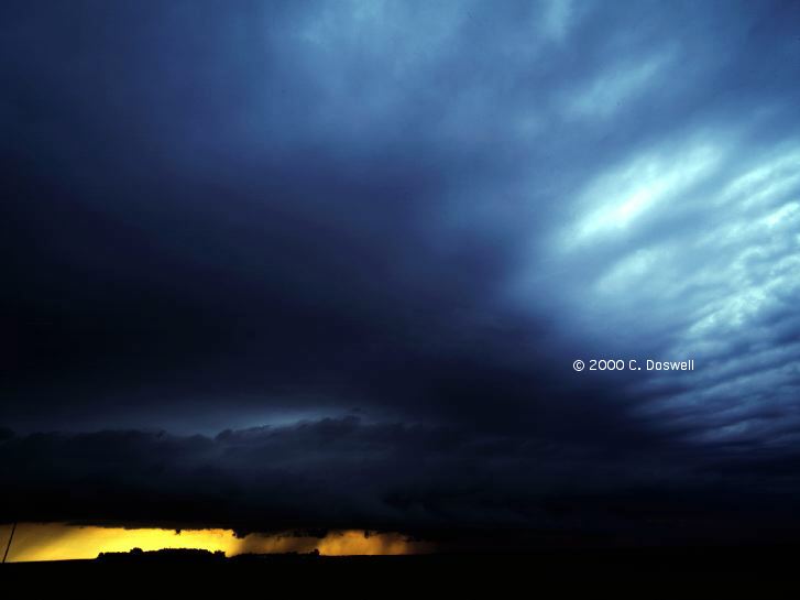
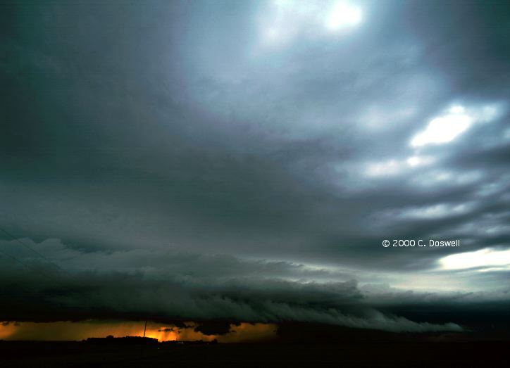
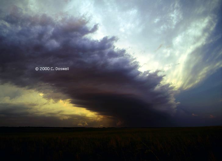
Another frustrating day. Cirrus overcast approaching from the southwest seemed to doom any chances on the western parts of the plains, and the best situation seemed to be in northeastern ND, so we roared off in that direction, under the cirrus. Finally saw some towers developing ahead of us by the time we got to BIS. It was a loooong drive to flank the westernmost of these. It turned out to be a multicell mess, but we got some nice images of the storms late in the day, including new cells developing to the west. Then we closed in under the towers and found a multilayered shelf (another look, here). The storms seemed to be pushing outflow westward, not southward. No tornado chances from this crap, but it was clear they would be heavy rain producers. It was a long drive for what turned out to be non-tornadic storms, but we got some decent images, anyway. Turns out the tornadic storms were ahead of us (see here for what we missed!!) ... we might have had a chance if we'd kept pushing.
Route: Left Mayville, ND on ND200 east to I-29, then south to US30 near Missouri Valley, IA, northeast to IA44 southeast, to Portsmouth, IA, then southwest on IA191 to I-80, southwest to US81 near York, NE.
A third frustrating day in a row ... made the long haul south through lots of construction delays on I-29. What I saw in west central IA was a storm that looked very undercut (apparently, this might have been what was left of the "Persia" tornadic storm), so we went farther south and saw a high-based storm that was all messed up ... overall, it was a rainy, sloppy mess with too many storms, in the process of turning into an MCS, so we bailed. Apparently Al M. caught a tornado in northeast NE - good for him! We're done and on the way home.
Route: Left York, NE south on US81 to I-135 north of SLN, to ICT, south on I-35 to OUN.
Traveling home. Stopped for a view of a distant line of storms, and that's about it.
This year, good chasing opportunities were hard to come by. For me, it seemed that the ingredients for good chase days just never seemed to come together ... something always seemed to happen to reduce the tornado potential (cold surges, cirrus fields, too many storms blowing up, shear separated from the CAPE, etc., etc.). Tornadoes were there on some days, but they were tough to get. I appreciate my luck in other years when I have a year like this.
We did manage to get some nice storms, and good images of them, plus I got some decent lightning shots this year on a couple of occasions.
The dearth of good, relatively obvious opportunities seems to have kept chaser convergence down, somewhat. The folks we did run into were old friends and so were welcome opportunities.
I tried using a cell phone for mobile hook-ups to the Internet this year, with some guidance from Daphne Zaras and Jim Ladue. It worked reasonably well on several occasions, though loading was occasionally slow. Keep bookmarks of favorite items to avoid waiting for index pages to load!
My chase vacation included my wife and favorite chase partner, Vickie, for the whole time. We chased with John Monteverdi from 01-08 June, and Al (OF) Moller from 05-11 June, they being in separate vehicles.
Acknowledgments. As is typical, I appreciate the hospitality and encouragement I get from visiting NWS offices, which I will continue to do, even as the Internet sets me free from the absolute need to do so ... special thanks to my friends at LBF, DDC, and RAP.
We visited Nebraska and the Dakotas this year to a considerable extent. The western parts of these states are pretty nice country and remain relatively undiscovered. We were in 10 states this year: OK, TX, KS, NE, CO, WY, SD, MT, ND, IA. We found nice places in all of them. Southwestern ND and southeastern MT were very interesting and will repay visits in the future.
Earlier in the spring (the date is now forgotten) I got a nice shot of horizontal lightning.
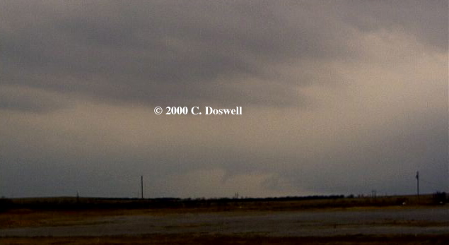
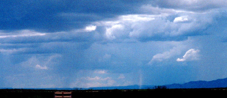
On a camping trip with my Boy Scout troop, we saw a tornado (non-supercellular!) just to the east of the Davis Mountains, on July 2nd. It's the dust column to the right of center ... I know it's not a dust devil, because you don't get dust devils under updraft bases! Thus, I have seen a tornado this year. <);-) However, I did not shoot this picture ... it was taken at 70 mph on I-20 by my friend, Don Carter.
These have been updated and consolidated into a single new page, here.