NOTICE .. Any duplication, electronic or otherwise, of the images at this Website without my expressed permission is a copyright violation, and I will treat it as such. Do us both a favor and ask me for permission before using any of the images herein ... you can e-mail me at cdoswell@earthlink.net.
NOTICE .. All images I show on this have been scanned from original slides or captured from video, with some digital enhancement (touch-ups of dirt on the slides when scanned, and some modifications of the scanned images and frame captures to make them look more like the original slides or to enhance the image quality). I do not alter my images digitally to put in things that were not originally in the image or remove things that were originally in the image, and I do not make digital composites. I am personally opposed to such image manipulations unless they are admitted to clearly and obviously.
Route notation: "USXX" denotes US highway XX, "I-xx" denotes Interstate highway xx, "SSxxx" denotes state (SS) highway xxx, "FMXX" in TX denotes farm-to-market highway XX. Wherever possible, cities that are National Weather Service sites are identified with the appropriate 3-character identifier.
Route: OUN, north on I-35 to ICT, north on I-135 to SLN, north on US81 to US24, west to KS14, north to ~4 south of Jewell, KS, then south to ~8 south of Beloit, KS, then north to US24, west to US 281, north to Smith Center, KS
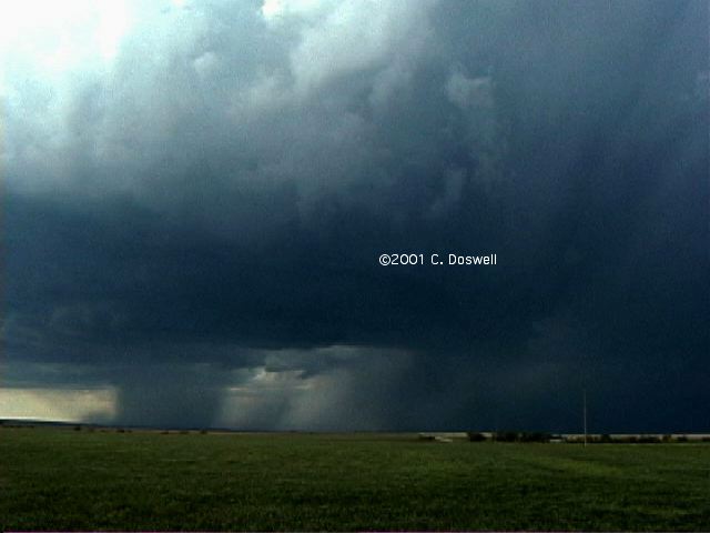
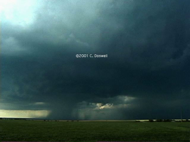
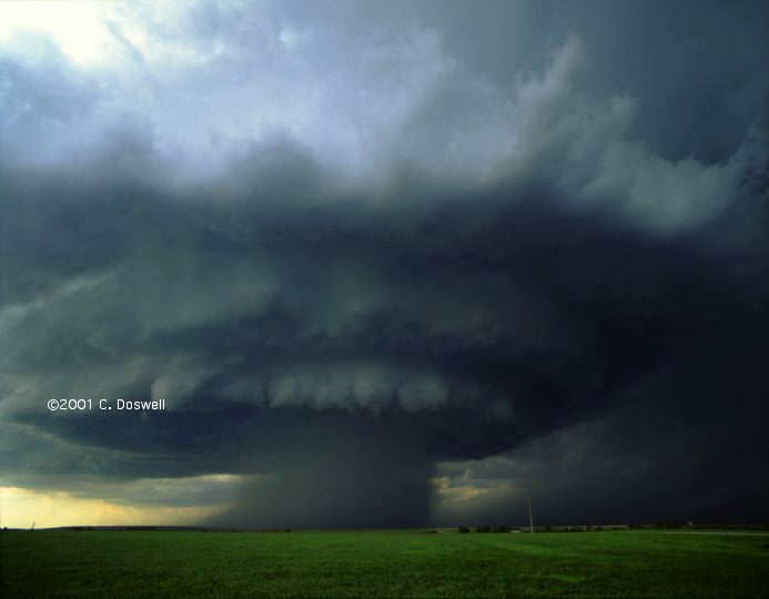
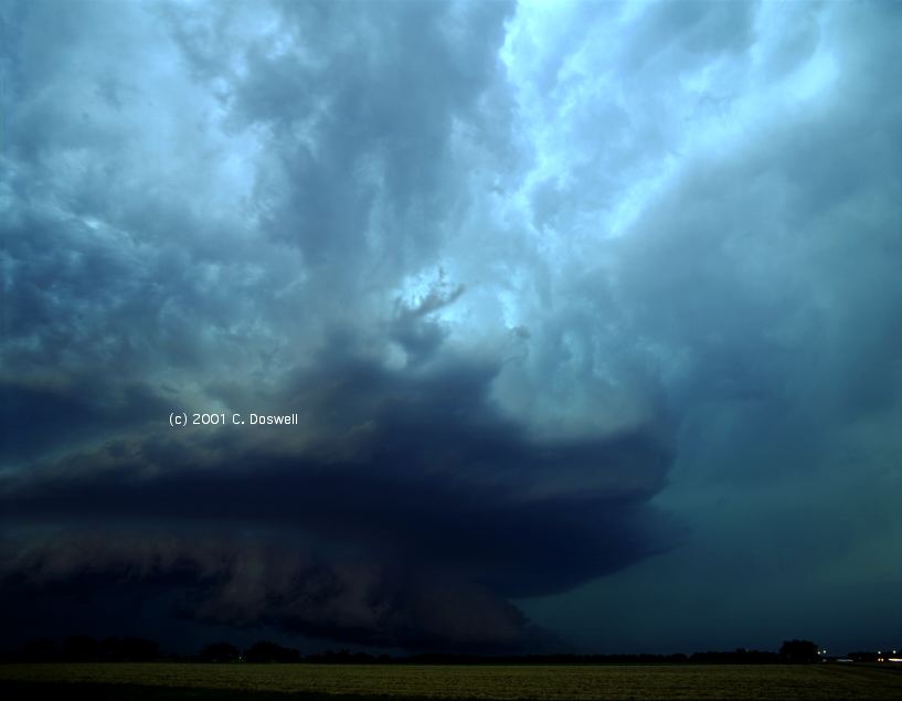
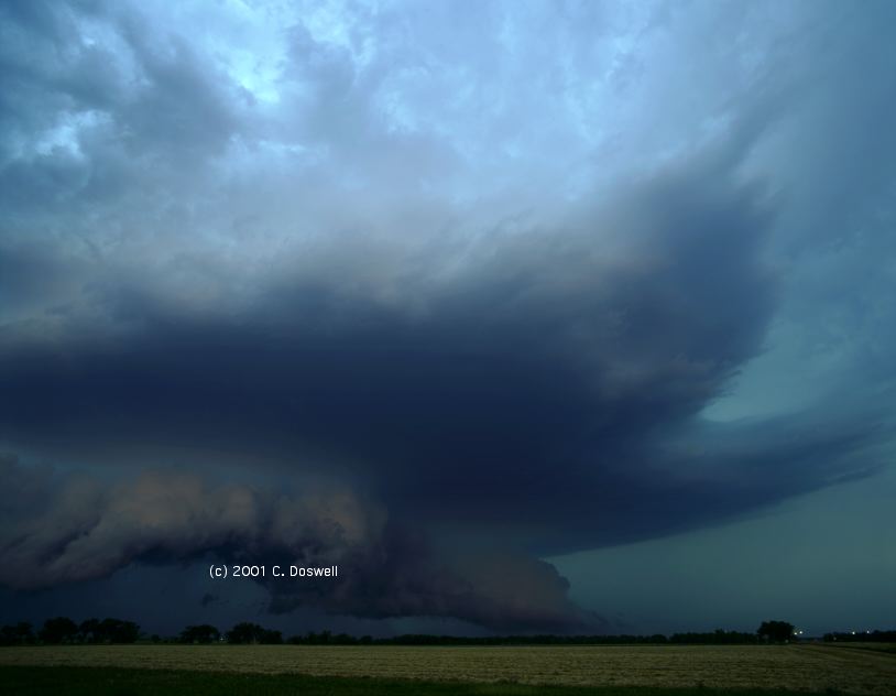
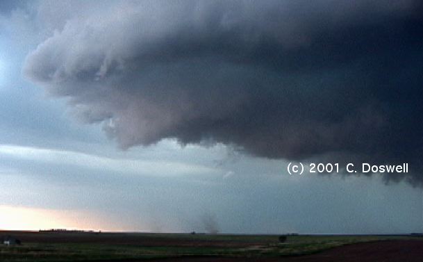
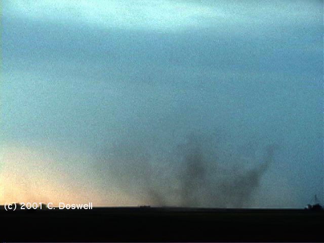
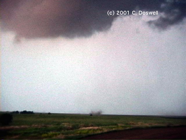
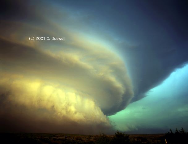
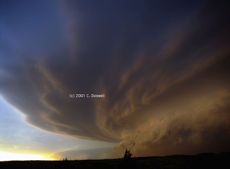
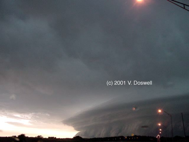
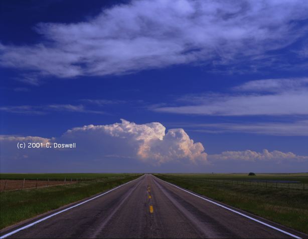
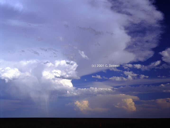
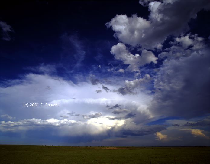
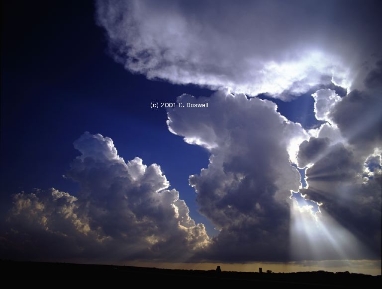
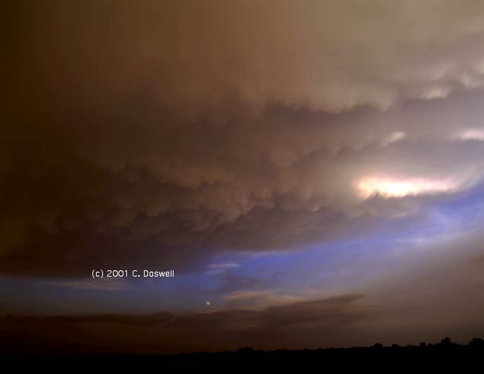
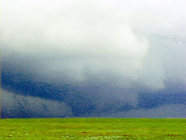
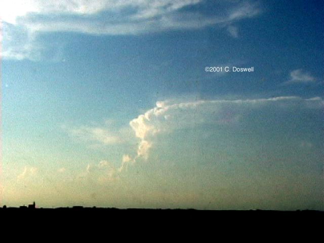
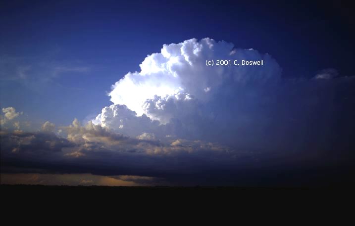
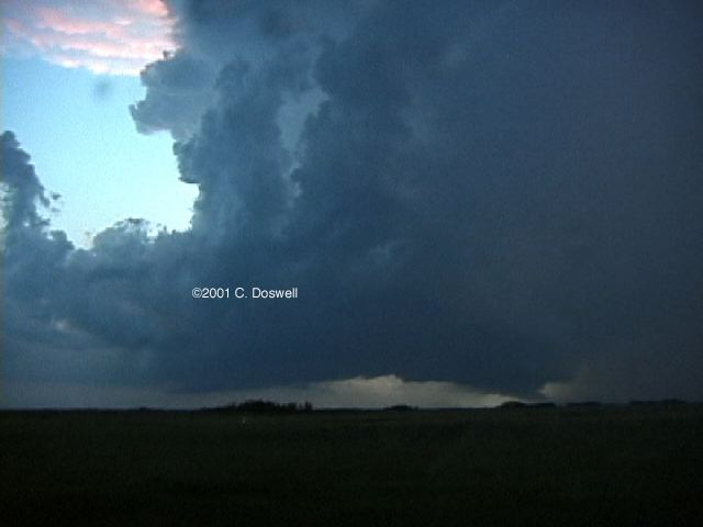
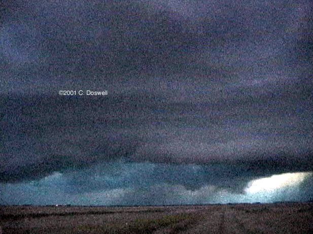
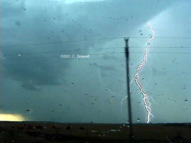
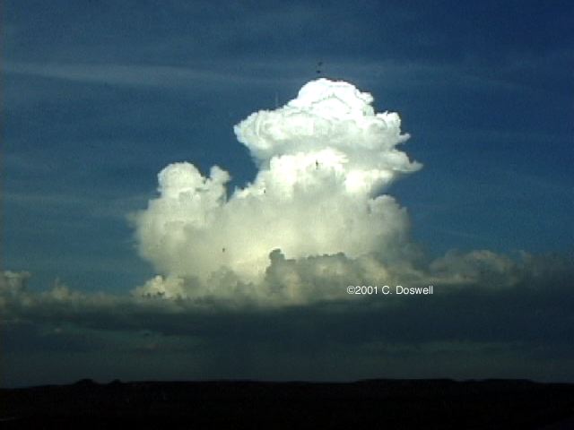
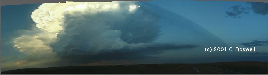
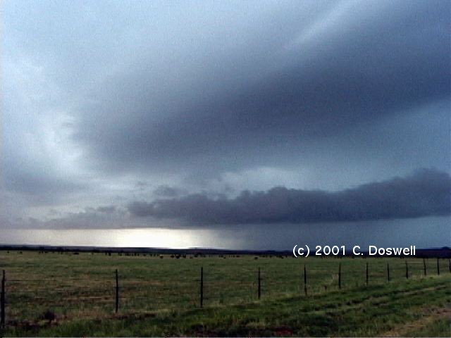
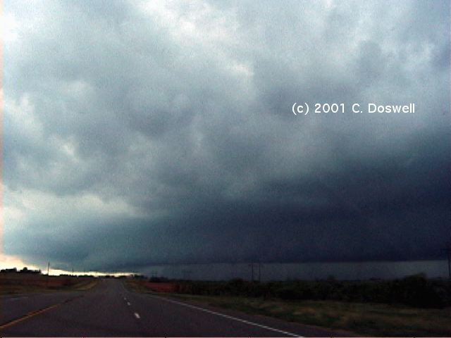
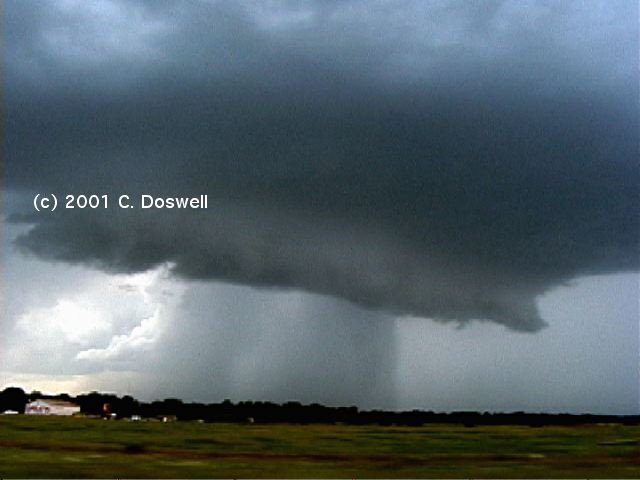
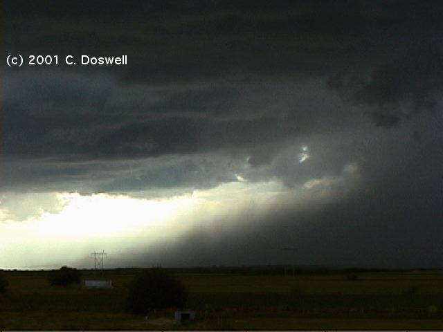
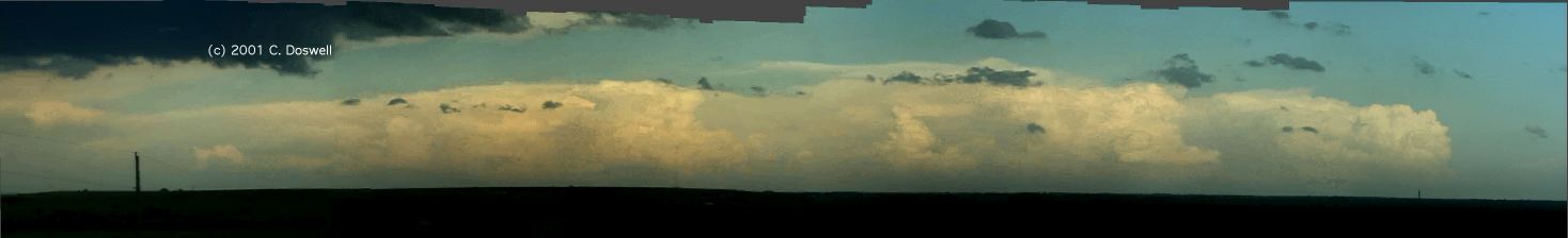
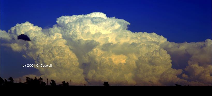
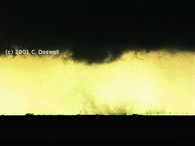
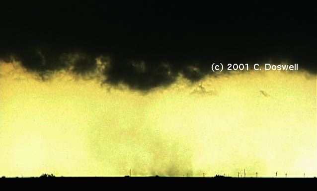
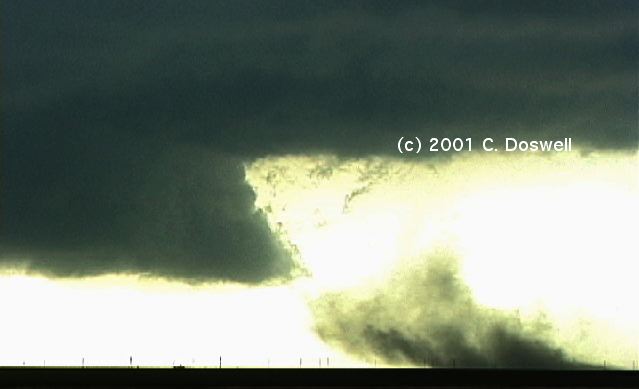
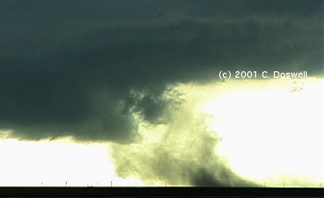
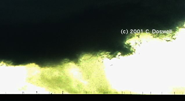
Great day! Started out with very low expectations, but we began to see weak thunderstorms while driving north of ICT, so we went west to avoid running into the cores, and blundered into a very pretty supercell near Jewell, KS. We had great position and the storm was moving pretty slowly, so shot video and stills for quite a while. The storm put down a heavy precip core into its RFD, so the apparent tornado potential was low, but it was very pretty. Upon looking at the video, one or two brief tornado touchdowns probably did occur, shortly after we arrived, but we discounted them at the time, as scud! When we first arrived, the storm looked like this, and evolved into this, then this, then this before the "tornadic" phase ended. After that, it got a very nice look, even though it wasn't producing tornadoes. The storm was moving nearly due south, slowly, so we also drifted southward. In Beloit, as the storm came in, they blew the srrens, but the storm was being undercut with cold outflow. A very pretty, but weak, storm was to our south-southwest when we moved just south of Beloit. As the nearby storms dissipated, a continuing complex was seen north-northeast at sunset, as well as nice accas clouds. Lots of contrails! All in all, this day was nice tonic for my SDS (supercell deprivation syndrome)! Stills and video shot.
Route: Smith Center, KS, north on US281 to HSI, north on US281/34 to I-80, east to OMA, north on I-29 to SUX, northeast on US75 to LeMars, IA, north on US75 to Rock Ranch, IA, east on IA9 to US71 to Jackson, MN, east on I-90 to Fairmont, MN
Classic day of not being able to catch the storms in the dreaded "stern" chase (chasing from behind the storms). We went northeastward toward a retreating warm front and ran into a line of developing towers near SUX on the leading edge of the dry air (which moved eastward faster than expected), so we headed northeastward, hoping to find backed winds and lower temp/dewp spreads, and moisture. Couldn't catch up with the warm front, which ended up in central MN. The advancing dryline/front moved well east and we just couldn't catch up with anything. Stopped briefly west of Sibley, IA and shot the storms developing behind us, to the south. We're probably way out of position for developments tomorrow as a result of this stern chase bust. Ended up about 100 mi away from Northfield, MN tornadoes, even after a long drive. No video.
Route: Fairmont, MN, west on I90 to FSD, south on I-29 to Nebraska City, NE, west on NE2 to LNK, west on I-80 to GRI, south on US281 to HSI
Another classic type of chase bust. Struggled to choose: south into worked-over air in IA or southwest into NE for best compromise of dynamics and thermodynamics. The day turned out rather differently than I expected. Southwesterly flow became widespread ahead of the cold front, even into IA. Front came south faster than I hoped for ... while we were headed west, the front came through, so by the time we got to HSI, north winds! The intrusion of dry air cleared the skies in IA, apparently helping the airmass recovery, and even though the surface winds ahead of the front were southwesterly in general, I forgot it was a day with northwest flow aloft ... result? Tornadoes in IA!! A dead day for us, though, with lots of miles. No stills, no video.
Route: HSI, west on US6/34 to MCK, south on KS27 to 1K5, south on OK95 to Texhoma, OK, southwest on US54 to Stratford, TX, south on US287 to AMA
Yet another classic bust. The hoped-for upslope convection on the high plains of CO, southwestern KS, northeastern NM, and into the TX Panhandle was capped off, so nothing fired except junkus on the front. Arrived in AMA to see the frontal convection, but blew off the storms. We may be close to done, for the time being..
Route: East on I-40 to US287, southeast to Claude, TX, south on TX207 to Silverton, TX, east on FM256 to South Brice, north on TX70 to I-40, east to OUN
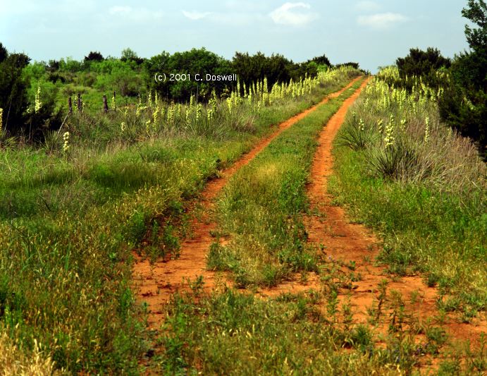
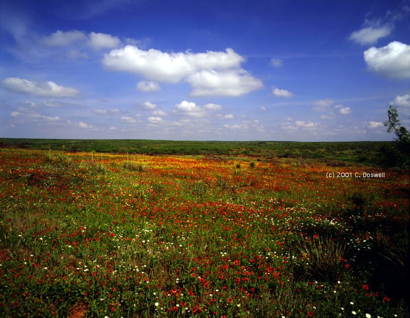
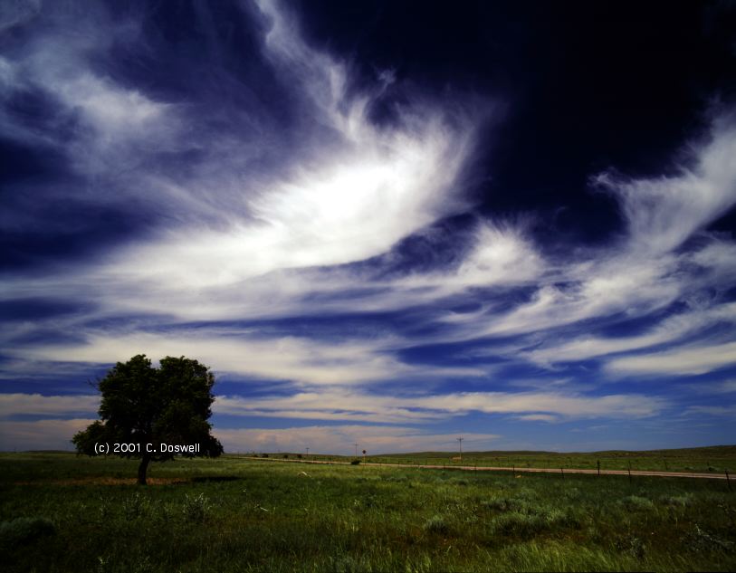
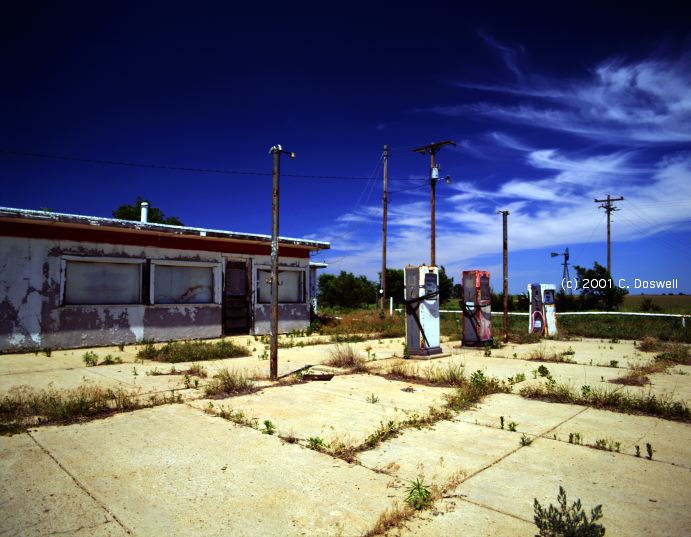
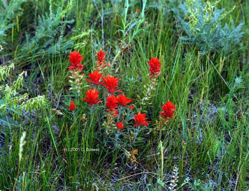
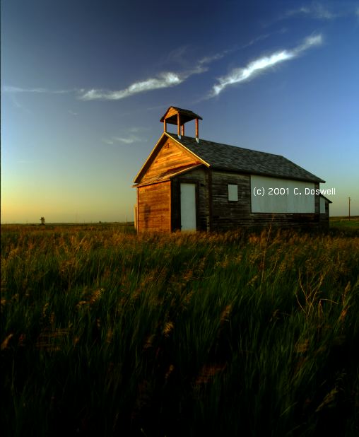
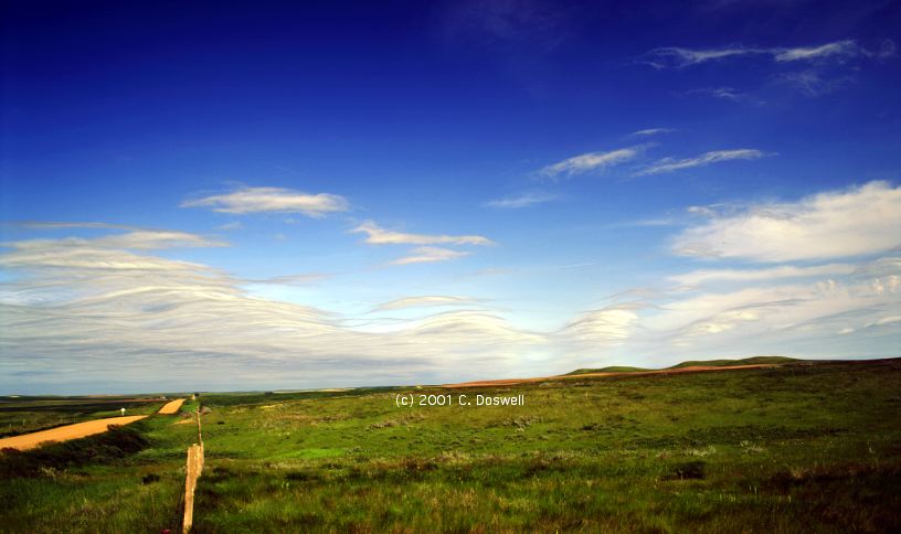
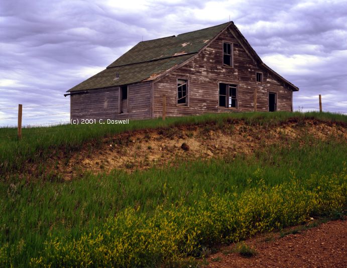
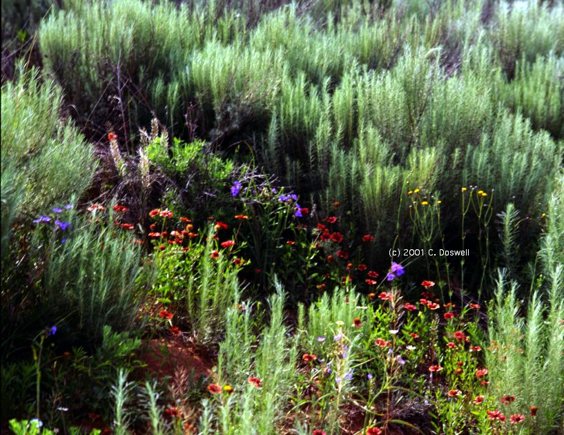
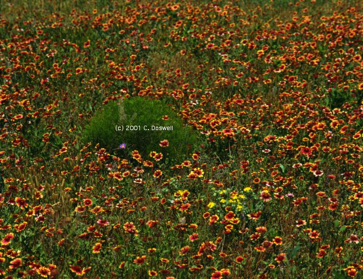
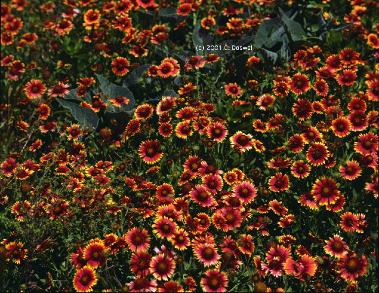
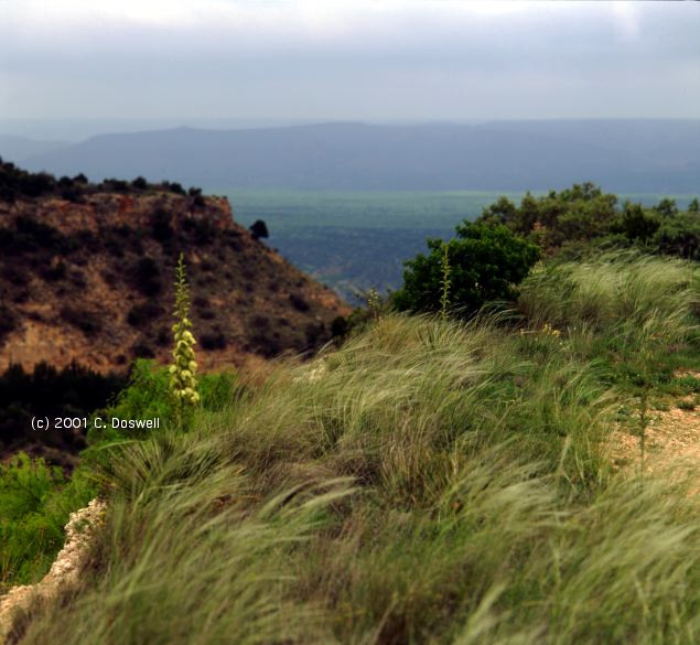
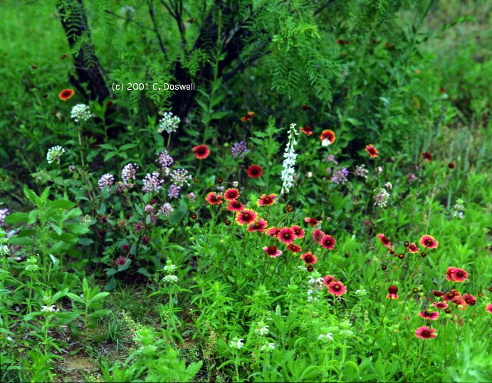
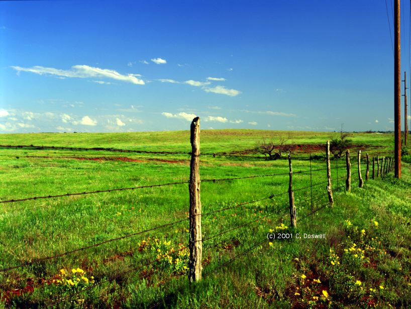
A down day stormwise, so shot various items on a detour south to the Palo Duro Canyon, and then back to I-40. Lots of clouds most of the day, finally clearing by late afternoon. The TX Panhandle is exploding with wildflowers everywhere, including forests of yucca blossoms, and occasional carpets of gallardias mixed with various other species. A gorgeous, relaxed day. Shutting down the chase since the pattern sucks so bad right now. We expect to start again in about a week or so. (Actually, it turned out to be two weeks!)
Route: OUN, southwest on I-44 to SPS, west-northwest on US287 to Estelline, TX, west on TX86 to Turkey, TX, south on TX70 to Matador, west on US62/70 to FM651, south to US82, west to FM400, south to US84, northwest to LBB, TX289, north to I-27, north to AMA.
Waited for something to happen at Estelline, dewpoints in the mid-60s at CDS seemed promising, and storms fired to our southwest. Went after them, and they looked good at the start, but the closest storm wasn't producing precip and seemed rather inert, so we broke off and tried to get to the next storm to the southwest. We never could catch up with it, and it seemed to be going downhill, so we blew it off and headed to AMA to be in position for tomorrow. No video or stills.
Route: AMA, US60 to Pampa, TX, north, then east on FM282, to TX70, north to US83, north to LBL, northeast on US54 to Meade, KS, east on US 160 to US183, north to US54, west to US400, to Ford, KS, then back east on US400 to Bucklin, east on US54 to US183, south to KS1, south to OK34, south to Woodward, OK, north on OK34 to US64, west to US183, north to KS160, west to US283, north to DDC
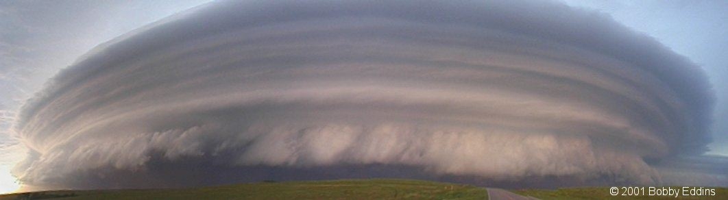
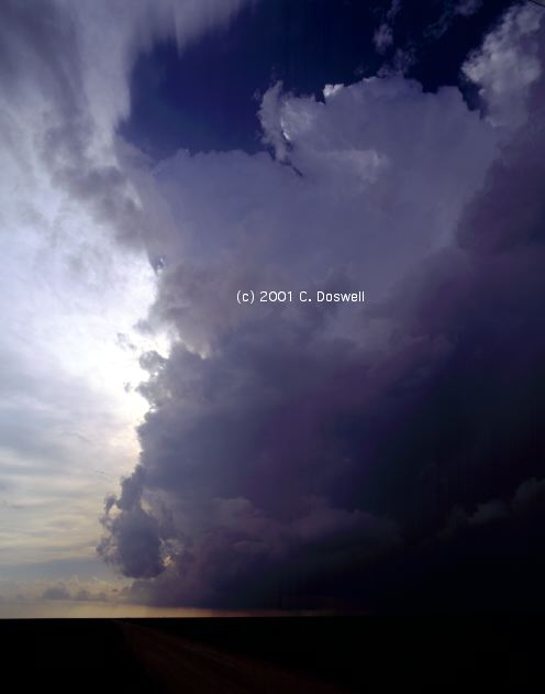
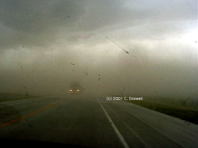
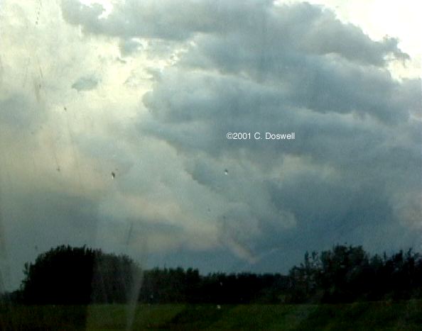
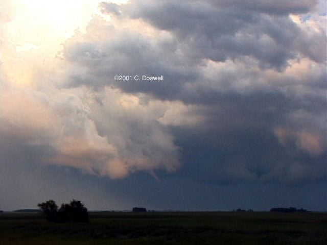
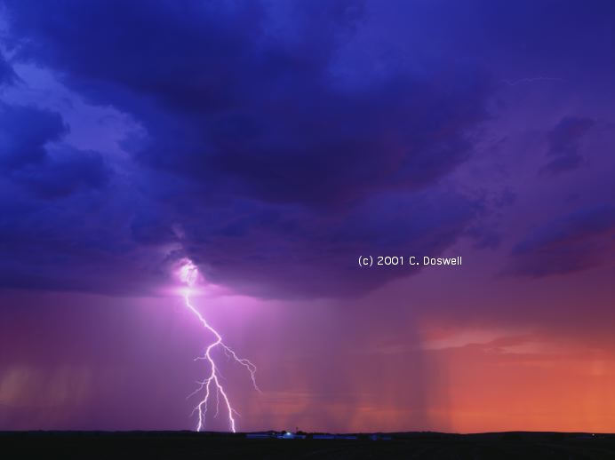
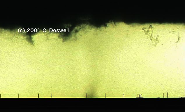
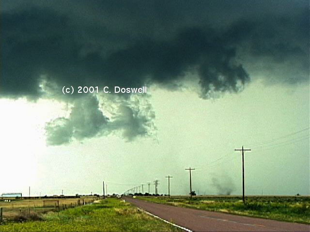
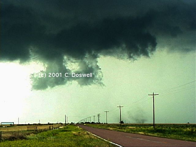
Great day, but short of a tornado. Chased my forecast into southwestern KS, blasted eastward after some early-developing stuff, but couldn't catch it, so diverted northward toward darkening skies in the northwest. In Ford, KS, encountered a supercell with terrific structure, including a wall cloud with a tail cloud, that apparently came very close to producing a tornado. Later, it began to show signs of developing more RFD outflow. Later still, there were some gustnadoes, shown here, here, and here, on the outflow, seen while east of Ford, KS. Made a navigation error in Bucklin and went east instead of south ... into rain from a storm to the east of ours, so we lost contact with it. By the time we got out of the rain, and reacquired our storm, it was very definitely outflow dominant ... it had become a spectacular HP beast. As if that weren't enough, another storm just like it was following to its WSW! Here's our view of the westernmost storm, in Woodward, OK. [Bobby Eddins had more spectacular views of the westernmost HP supercell here and here, put together as panoramas from his video - our storm in Woodward is in the distant right of his panoramas.] The pair of storms made for a wild sight coming into Woodward, OK, where we took shelter under a Love's roof. Our storm blasted into town with about 30 mins worth of strong winds I'm guessing peak winds at about 60 knots), but no hail in spite of the green color. Power went out in the Love's. After letting the worst of the wind and rain pass, we headed back to DDC to re-unite with John Monteverdi. On the way, we were treated to a nice sunset, but continuing anvil rain precluded getting any images. While waiting in the Love's, we called home on our cell phone and alerted our daughter (who was house-sitting for us) to get ready. When it blasted through Norman that night, it took down our Bradford pear tree, which in turn smashed a section of our back fence. There was some other minor damage but we were lucky ... it could have been much worse.
Route: DDC, south on US283 to Minneola, KS, southwest on US54 to Guymon, OK, west on US64 to Boise City, south on US287 to AMA, south on I-27 to Canyon, TX, southwest on US60 to Hereford, TX, south on US385 to Littlefield, TX, southeast on US84 to LBB
A bust. Low clouds and cold temperatures under cirrus created a stable low-level airmass over most of Wrn TX, suppressing the opportunity of an advancing short wave trough. A squall line came through LBB with the trough during the early morning hours.
Route: LBB, northwest on US84 to Littlefield, TX, east on FM54, to FM1077, north to US70, east to FM179, north to TX194, southeast to FM788, east to FM378, south to FM2288, east to TX207, south to FM97, east and then northeast to TX70, north to FM656, east-southeast to FM94, north, then east to US82, north to CDS.
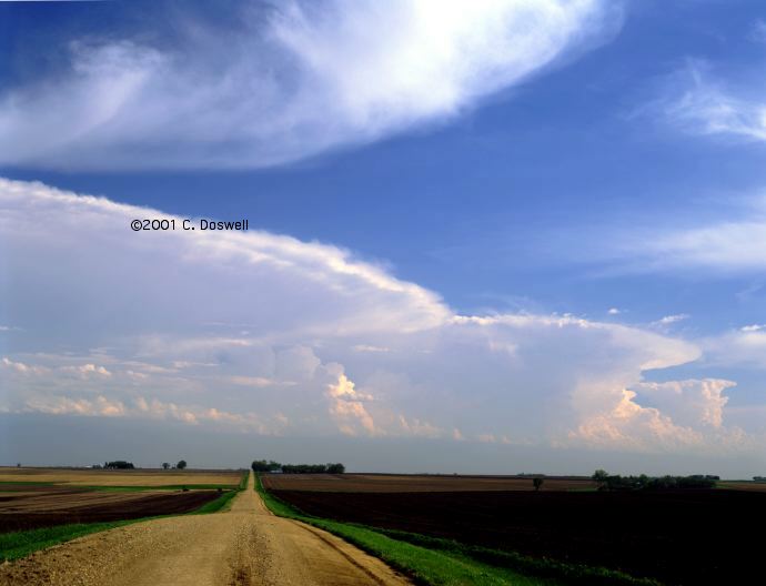
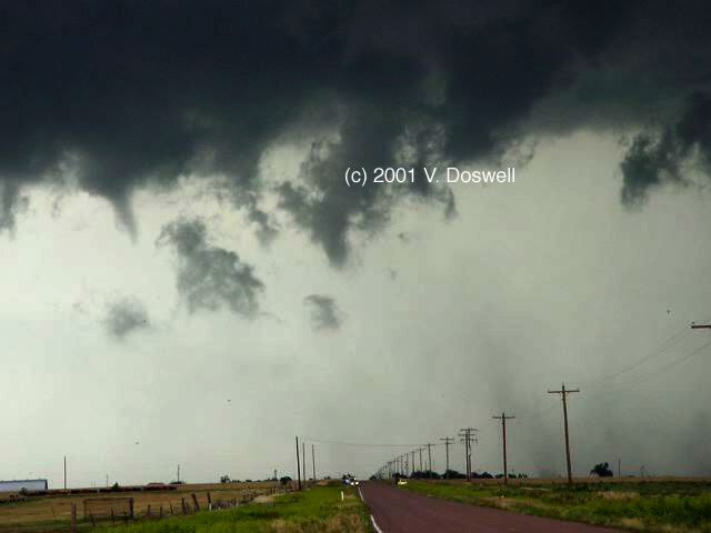
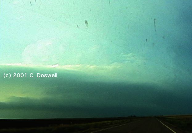
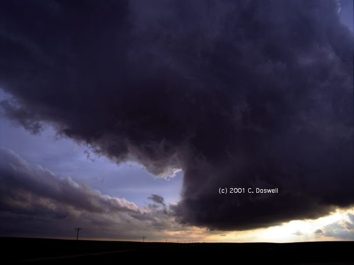
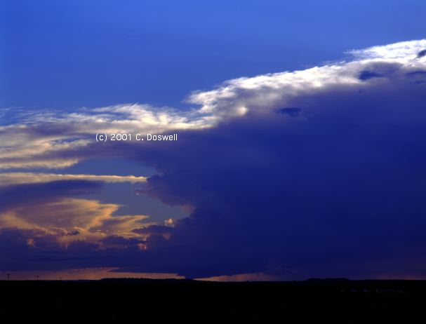
Yet another nontornadic supercell. After firing, the storm we chased was slow to develop, splitting left-movers off several times and moving northeast. We considered blowing it off for a storm we saw through its diaphanous precipitation, but we chose to stick with the storm we had ... a bad choice, this time. North of Lockney, TX it began to intensify significantly, becoming supercellular and on several occasions, rotated substantially at cloud base, producing apparent a funnel and some gustnadoes, but couldn't put down a photogenic tornado. Due to roads, we lost touch with it for a time, but reacquired the storm as it was propagating east-southeastward. When it was dropping off the Caprock Escarpment, our view of the storm (sorry for the poor quality of this image - my video camera was set incorrectly) from the south wasn't very exciting. However, as shown here, views of the storm from the east were fantastic! Storm structure often is at its best from certain perspectives, only!! Finally, as the sun was setting, we had to drive through it (praying for an absence of big hail) on the way to CDS. Major chaser convergence on this storm - most chasers, including the Mobile Mesonet team, the DoWs, etc. were on it. CDS was a mob scene, what with all the chasers in town - most restaurants were closed and the few that were open were jammed with chasers of all sorts. A fortunate few chasers (e.g., Sam Barricklow) avoided the hordes and caught tornadic storms in CO and in the northeastern TX Panhandle, notably near White Deer, TX (see Sam's page here). Our storm seemed to begin in prime environmental conditions when we left the office, but it seemed like the hodograph was faulty and the convection seemed a bit CAPE-starved early. It did get a kick in the butt as it was going off the Caprock, though - a not-uncommon evolution.
Route: CDS, east-southeast on US287 to SPS, north on I-44 to OUN
Took a look at the situation and decided this was a day to blow off and go home so Vickie could take care of a prior commitment and we needed to deal with the damage in our yard resulting from the 27 May derecho.
Route: OUN, I-40 to AMA
Nothing day ... reunited with John M in AMA
Route: AMA, Loop 335 to US287, north to Stratford, TX, northeast on US54 to Minneola, KS, south on US283 about 20 miles, then back north to US160, west to US54, then souhwest to LBL
Another weakly-rotating storm. We negotiated a typical KS construction delay in Minneola, KS to get south to a small storm with a horseshoe-shaped updraft base ... that dissipated at sunset. A minor chaser convergence with this one, including old-timers Matt Crowther, Betsy Abrams, Gilbert Sebenste, and others.
Route: LBL,north on US83 to US160, west to CO109, north to CO96, southwest to Ordway, north on CO71 to 15 north of Punkin Center, back south on CO71 to Rocky Ford, east on US50 to LAA
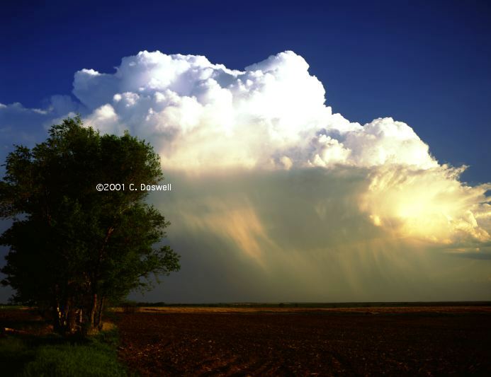
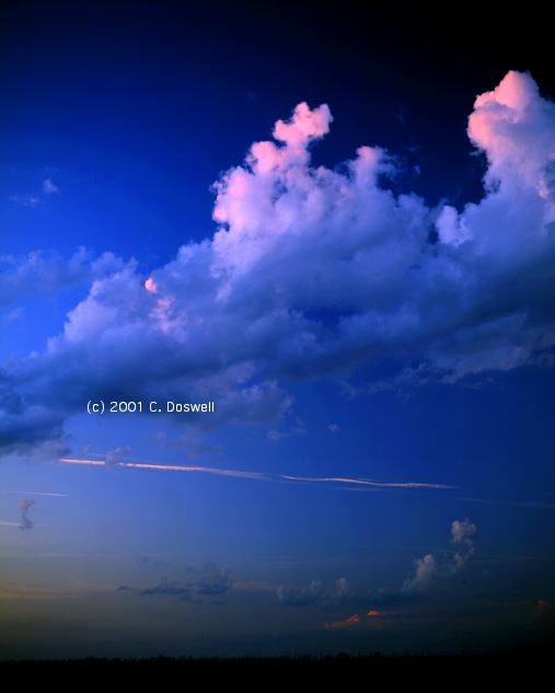
Not a bad day. Chased some storms that apparently went up on Raton Mesa early. Then we saw other storms developing north, so we roared off after them, only to see them dissipate. Then some more storms went up behind us. Even though the storm that evolved had a high base, it had a nice anvil ... then it went downhill and was dissipating, until it seemed to get another surge for awhile. But it also pooped out at sunset and we were left with what amounted to an orphan anvil. No video, but I took some stills that should be nice.
Route: LAA, east on US50 to DDC, south on US283 to OK11, east on OK11 to Blackwell, OK
Another type of bust. Great potential in the situation, but a strong cap held things down until after dark. Ran with BC and Ed Calianese, after meeting them on the road. No stills, no video.
Route, Blackwell, OK, west on OK11 to OK132, north to KS179, north Anthony, KS, north on KS14 to Kingman, KS, east on US54 to KS17, north to Hutchinson, KS, east on US50 to Newton, KS, northeast to Florence, KS, south on US77 for 5 miles, then back on US77 to US50, southwest to Peabody, then northeast for 6 miles, then back southwest to Newton, KS
Another way to get a nontornadic supercell. Strong cap kept storms from firing until late, then the first storm went up well south of us while some weak turkey towers struggled to get cycled up. Weak winds aloft created a fake "backshear" as stronger winds in midtroposphere would blow the storms into a V-shape. Finally, a supercell got going near Peabody, KS (this link is intentional .. read the paper) ... giving about a 30-40 min show before falling apart as the sun went down. Major chaser convergence again, We had a late supper in Newton with Tim Samaras, Al Pietrycha, Al Moller, Matt Biddle, etc. Saw Matt Crowther and Betsy Abrams, Chuck Robertson, etc., etc. during the day. The atmosphere drew a bulls-eye in the area and then failed to do very much, but we did did see some nice crepuscular rays, and some mammatus over the rising moon.
Route: Newton, KS, north on I-135 to I-70, west to LIC
Perhaps we screwed up big-time, but we blew off the chances along the front in KS, OK, and TX, choosing to go to CO instead. Nothing happening so we stopped in LIC. We have hopes for tomorrow. Last day with John M.
Route: LIC, north on CO71 to I-76, northeast to I-80, east to NE61, north about 25 miles, then back to I-76, east to LBF, north on US83 about 16 miles, then back to NE97, northwest about 5 miles, then back to US83, south to NE23, then west to NE25, north to I-80, east to LBF
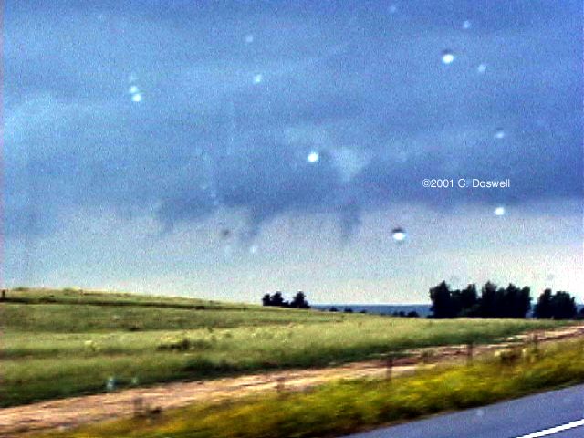
Weakly rotating storms developed north of I-80. Saw some brief funnels. Early storms were not producing much precip but were clearly rotating. Later, they began to form along a line. Saw what might have been a weak tornado or funnel north of LBF, but storms were repidly being undercut by outflow. Surface winds were weak and as storms backbuilt toward the west each in turn would be undercut by outflow/the advancing front. Hence, another bust, although at least we had rotating storms yet again.
Route: LBF, west on I-80 to Kimball, NE, north on NE71 to BFF, northwest on US26 to 5 miles northwest of Mitchell, NE, back on US26 to BFF, west on NE92 to near Huntley, WY, south on WY158, east on unnumbered road back to NE92, east to BFF, south on NE71 to CO71, south to CO14, then back north on CO71 about 10 miles then back south to CO14, west to New Raymer, north on unnumbered road about 10 mi, then west on an unnumbered road about 3 miles, then back to New Raymer, then west on CO14 to 1 mile west of New Raymer, then east on CO14 to CO52 to Fort Morgan, CO
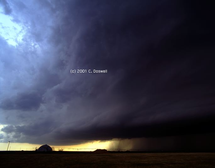
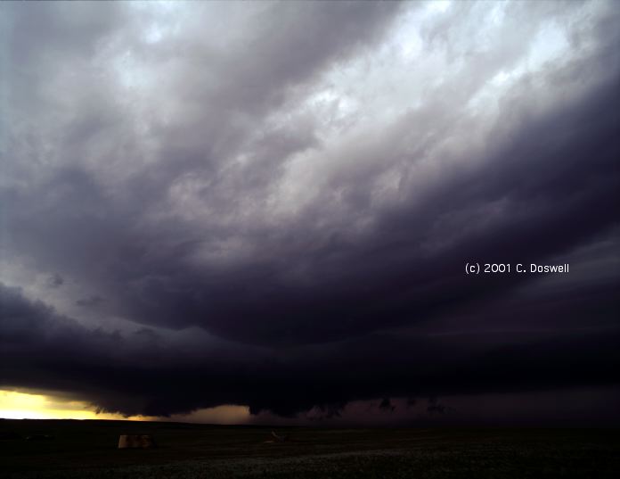
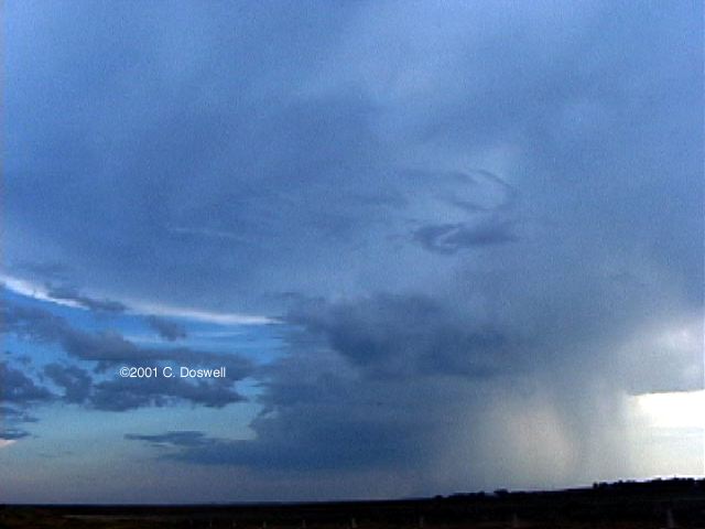
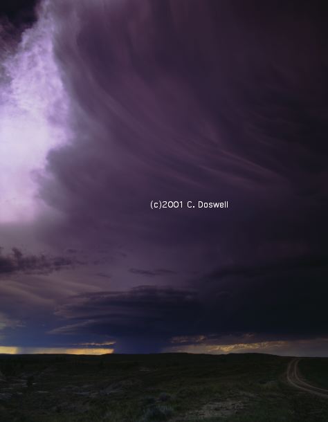
A wild day. Began with various frustrations as we drove to the edge of the low clouds, then north to BFF. After various misadventures, headed south. Passed by a relatively weak multicell storm and saw a storm to the southeast. Ran into Steve Hodanish at the intersection of CO71 and CO14, just as the storm we had passed got its "fist" and took off into a honking supercell. We (Ho and us) got as close as we could via dirt/gravel roads and watched as it developed great structure and some interesting lowerings. It seemed to get bigger and bigger as the precip got closer, and then was propagating westward, so we headed back south, and then west to get a better angle. A nice LP storm developed nearby and eventually was absorbed into the main updraft of our storm. Meanwhile, a possible tornado developed, but since it was relatively far away and the contrast was bad (so this image has been digitally enhanced over the original), we could not be sure of about the tornado. A line of TCU to the south of us merged with the storm and became its main flank, with a new meso. Took some long video from the north side of the flank, as the sun began to set. Unfortunately, the storm collapsed at sunset, so no lightning. No photogenic tornadoes (apparently, although it may have produced one we could just barely see), but a fun chase and a storm that developed more than I expected. Shot a sunset image late. Ate a nice supper with Ho in Fort Morgan, and then we went our separate ways.
Route: Fort Morgan, CO, east on I-76 to Brush, CO, then north on CO71 to CO14, west to CO52, south to Fort Morgan, CO, east on Road "R" to Brush, CO, south on CO71 to 3 south of Last Chance, CO, then back north, then back north to CO14, then back south on CO71 to Last Chance, CO, then west on US36 to Byers, CO, then southeast on I-70 to LIC, then southeast on US287 to LAA
A day of indecision and frustration, mostly spent vacillating between north and south on CO71. Finally, saw what looked to be a good storm going up south of us, so we finally dove south, in spite of what appeared to be better meteorology to the north. Storms were propagating to the southwest, however, which was not good. Ended up busted and depressed in LAA. Shot some nice stills, perhaps, but nothing good happened as we near the end of our chase.
Route: LAA, east on US50 to Granada, north on US385 to 3 miles north of Wray, CO, west on CO county road 39 one mile, then back to US385, south to Burlington, CO, west on I-70 to CO59, south to Kit Carson, Co, south on US287 to LAA
Weak supercells today. It's hard to call the day a bust, but ... we wound up seeing little ahead of us and a storm blowing up behind us, so we stopped in Wray, CO and watched the storms for a while. The first storm was pretty and the cirrus in the sky was gorgeous. Eventually another storm went up closer to us and we watched it for a while. It was weakly rotating, anticyclonically and apparently developed some cyclonic rotation on its south flank. Meanwhile, the first storm southwest of us kept getting bigger and darker underneath. Eventually, we decided we had to go after it, because the nearby storm was pretty inert. When we finally got there (near LIC), we had a few minutes to shoot some mediocre daytime lightning before the gust front overtook us. The storm chased us southward, developing into a gusty, dusty mess, with winds of order 85 mph (we were doing 85 mph briefly, trying to get ahead of it, and it was slowly getting away from us). It created some posslbe tornado look-alikes, though. The haboob chased us back to Lamar.
Route, LAA, east on US50 to DDC, south on US283 to US64, east to Buffalo, OK, south on US183 to Woodward, OK, southeast on US270 to I-40, east to OUN
A leisurely trip home. Stopped for some artsy stuff, once.
Route: OUN, I-35 north to ICT, I-135 north to I-70, west to DIA, southeast on I-70 to Byers, CO, east on CO36 for about 2 miles, then back to I-70, to DIA
Met the tour group at DIA, and we moseyed out east a short way to watch storms and get acquainted. Storms were pitiful, so we went back to the motel. Saw some nearby lightning after supper, but the storm died shortly after we got out after it.
Route: DIA, south on I-25 to COS, east on CO94 to Yoder, CO, south on Yoder Rd to 1 south of Truckton, CO, then back, east on CO94 to Punkin Center, north on CO71 to LIC, then east on I-70 to Seibert, CO, north on CO59 to US36, west to CO81, north to Sterling, CO
A day with a lot of promise that apparently was hurt by mountain thunderstorms. Some weak mountain storms moved out over the plains early and rained, producing a pool of cool, stable surface air. Storms that developed later would dissipate when they encountered this. Went east and then north to get out of the cool pool and saw what might have been some brief funnels near LIC but these storms gusted out rapidly and the storms appeared to develop into a short squall line and move rapidly southeastward, so we bagged it. In Flagler, CO we downloaded some radar and discovered that a very severe storm may have produced a tornado near DIA! Fortunately, no hail damage to my parked car (in the motel parking lot a few miles southwest of DIA) occurred, in spite of large hail having done extensive damage at DIA.
Route: Sterling, CO, southwest on US6 to Fort Morgan, CO, then I-76 to I-270, east on I-70 to I-225, south to I-25, south to Castle Rock, then north on I-25 to CYS.
A day with low expectations, fulfilled. Hung around near Castle Rock for awhile, waiting for the remote chance of a "Colorado Magic" storm, and doing some local images, but storms just didn't happen. Getting ready for the weekend in the Dakotas.
Route: CYS, I-25 to US85, north to Bowman, ND (with a detour around the Cave Hills Rd)
A travel day for repositioning.
Route: Bowman, ND, west on US12 to MLS, south on MT59 to 3 miles south of Broadus, MT, back on MT59 to I-94, northeast to GDV.
Interesting day. Things were slow to get going. Visited the North Dakota Cloud Modification Project office in Bowman. Went west toward developing convection and heard a warning for southeastern MT, so we headed toward those storms. Saw a great lightning show developing to our west, but the chase country is tough in southeastern MT; too many hills and trees, plus a long construction site on MT59! Finally got a tolerable viewpoint near a golf course northwest of Broadus, MT. There were lots of repeating CG flashes for daytime shots and some staccato flashes, including some close strikes! After we were forced to move by the oncoming rain, had lightning hit within about 100-150 feet of us, in Broadus! We got a few more chances at lightning late in the day as the storms moved away
Route: GDV, MT16 northeast to Sidney, MT, MT/ND200 east to US85, north to US2, east to ND40, north to ND50, east to Burke County Rd 11, north about 10 miles, then back to ND50, east to ND8, south to Stanley, ND, east to US52, northwest to ND8, north to Sask9, north to Sask18, east to Mani256, south to US83 to MOT
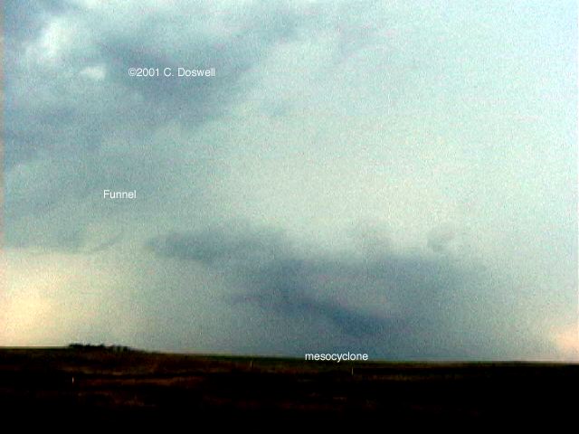
Wild day! The cap held things down until about 7:30 pm. Finally, a storm developed near the Canadian border that rapidly evolved into a nice supercell, with very nice structure. Unfortunately, it was in between east-west roads and we ended up going north into Canada (Saskatchewan and then into Manitoba), eventually circumnavigating the storm, which was moving slowly southeastward during our passage around it. We might have missed tornadoes during this circumavigation. However, we had some good views of the RFD area, eventually seeing a nearly horizontal funnel on the backside of the wall cloud at one point, that dissipated, and then of the mesocyclone from the east, which became undercut as daylight faded. With sunset, the storm crapped out. Back across the border (which was closed when we were coming back, just ahead of the meso!), we met Dave Gold and the Silver Lining Tours group. It may have produced one or more brief tornadoes at various points where we weren't close enough or in position to see, and the funnel we saw might have touched down briefly. Another "close, but no cigar" supercell for me.
Route: MOT, east on US2, north on unnumbered county road to Upham, ND, north on ND14 to ND2, east thru Bottineau, ND to US281, north to the Port of Entry, then back south, continuing east on US281 to Rolla, ND, south on ND30, south, then west, then south again to ND15, west to US52, south to ND200, west to ND3, south to Steele, ND, west on I-94 to BIS
The biggest event today was being stopped by a sheriff's deputy in Bottineau, ND during a convenience store "pit stop", while we were trying to intercept another apparent supercell in the late morning that was moving eastward some distance north of the Canadian border. Unbeknownst to us, there was an A.P.B. out on us after our illegal border entry the night before! We were "invited" to go to the port of entry station north of Dunseith, ND to explain to the border patrol there what we had done. [see "ups and downs", below] Once there, the station chief made it abundantly clear to us that we had committed a federal crime, and we tried to explain that we were forced to go south by a dangerous, severe, and potentially tornadic storm. He asked a lot of questions about what we were doing, where we were from, and wanted to know if we were going to make a habit of "it" .. without ever clarifying just what "it" meant. After getting everyone's driver's license copied and obtaining copies of the vehicle registration, he then released us to resume our chasing, after we were suitably chastised and apologetic. He also made it obvious that he didn't want us crossing the border anytime soon, anywhere near his jurisdiction. In the meantime, the supercell we'd been chasing moved away and was well north of the border ...
From then on, the chase was boring, as the storms in ND moving northeastward were not even remotely likely to be tornadic, and the cap held over the rest of the area we chased. We did see some nearby lightning strikes as we were driving in the rain, but that was about it for excitement. Took time for a "photo op" at sunset, north of Steele, ND.
Route: BIS, west on I-94 to Beach, ND, south on ND16 to Golva, ND, continuing south on unnumbered country road, then west to MT7, south to Baker, MT, then southeast on US12 to Bowman, ND
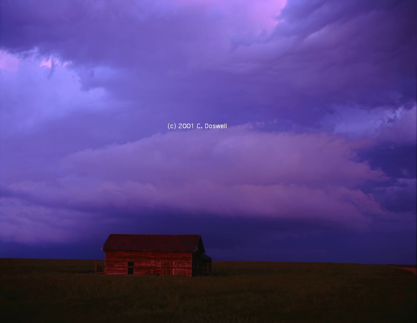
Nothing day. Thought we might have a chance for something coming east from MT or WY, but cool, stable air was advected in and suppressed everything. One "bonus" was that the stable layer produced some nice gravity waves. We had an enjoyable photo stop at an abandoned farm home south of Golva, ND.
Route: Bowman, ND, north on US85 to Watford City, ND, then south on US85 to I-94, west to exit 23, then back east to US85, south to Bowman, ND, then east to 3 miles east of LEM, then back to LEM
A frustrating day with a good ending. Moved north in anticipation of the advancing warm front. Storms fired in southeastern MT behind us, so we returned back the way we came and started for them. But new storms fired south of us, so we turned back once again and went after them. North of Bowman, we saw a high-based funnel near a rain-engulfed meso and another weakly mesocyclonic storm south of that one. But in the meantime, we discovered northerlies where there had been easterlies ... something had turned the winds locally ahead of the convection. In frustration as these storms dissipated rapidly, we headed east, toward the good instability. Nothing much happened but some relatively weak thunderstorms began to develop late in the day, including a new tower just ahead of us. We moved east a ways, found a convenient place to get off the highway a few miles east of LEM, and we were treated to a great daytime lightning show as the sun set.
Route: LEM, west-northwest on US12 to MLS, west on I-94 to exit 67, north on unnumbered road to Hysham, MT, west and south on County Rd 311 to 2 miles west of Myers, MT, north on Sumatra Rd for 11 miles, one mile west on unnumbered farm road, then back to Sumatra Rd, east and North to Forsyth, MT, east on I-94 to Rosbud, MT, then east on I-94 to MLS
Interesting day. We headed west to get to better winds aloft and a CAPE axis in southern MT. Found two supercells going on at once. The northern one became undercut (we observed northerlies in our position to the storm's east) and its wall cloud developed some interesting waves before it began to dissipate and move off to the northeast. The southern storm was moving east, a good sign, so we watched it move toward us for a while. Another apparent supercell developed to the west, which might have been tornadic but was so far away in a region of no roads, we stayed with the storm we were on, which continued to cycle up and down. As it moved eastward, it had a late surge in the evening and then began to dissipate, after we had watched it for about five hours! No doubt it was rotating, but it was high-based and never could tighten up the rotation. It was never a prolific CG lightning producer, for some reason.
Route: MLS, southeast on MT59 to Broadus, MT, southeast to Alzada, MT, south on County Road 236 to County Road 112, to Hulett, SD, south and west on US24 to US14, south and west to I-94, west to Gillette, WY, south on WY59 to 4DG, south on I-25 to DIA
Busted. Anticipated storms in easterly flow along the MT-WY border. Neither the flow nor the storms developed - had a nice visit at the Broadus, MT museum. When it became clear that we had busted, we had to get the tourists back to DIA for their flights home, so we drove past Devil's Tower and then on to DIA (got there at 2 am, to bed at 3 am).
Route: DIA, via I-70 to Salina, KS, south on I-135 to ICT, south on I-35 to OUN
A travel day. Back home.
Although things were better this year in some ways than last, good chasing opportunities were still hard to come by. It's never common to get all the ingredients for tornadoes together and the best events, like the White Deer, TX, tornado (on 29 May), proved elusive for us - we picked the wrong storms or were way out of position for the tornadic storms. As time goes by, it's obvious that I'm quite vulernable to the standard storm chaser mistakes. I can live with that, but misses are always frustrating. Like last year, we did manage to get some nice storms, and some good images, but tornadoes were hard to find. There never really was a day when tornado intercepts were "easy". Of course, this is one of the things that makes chasing fun ... if it was easy, there wouldn't be much fun to it.
Important Note: Although there are many possible roads to use for crossing the Canadian border during the day, only a small fraction of the border sites are staffed at night. It behooves chasers crossing the border into Canada to (a) get back across the border before the stations close (generally, at 10 p.m.), or (b) know which stations stay open 24 h per day and use them! If you feel you must cross the border illegally, as we did (i.e., after the border at a particular station has closed) because of imminent danger from storms, then go back to that station as soon as possible after it re-opens next morning and be prepared to explain why you did it. Illegal border crossing is a serious Federal crime and carries with it the possibility of vehicle impoundment, a $5000 fine, and jail time!! We got off easy, and no chaser should take this lightly ... repeated occurrences surely will result in the Border Patrol viewing storm chasers in a bad light. Rest assured, I will never let this happen again!!
Some observations: There were several days with major chaser convergence, including long caravans of chasers following the DoWs or tthe Mobile Mesonets like a column of caterpillars. We saw several occasions where chasers failed to pull completely off the road,. Some teams, even though the vehicle's tires were marginally off the road, the driver was hanging out the open driver's side doors, such that the open door and the driver were overlapping the roadway. I observed this several times with college-sponsored chase teams driving vans. One time, a friend of ours (Jason Jordan) had to screech to an emergency stop to avoid T-boning an idiot within a chase parade who decided to do a U-turn just over a hill on the road!
Many of my worst fears about chasing have been realized. It's now come to the point that the chaser convergences are hindering scientific observations by their sheer numbers (long "convoys" of vehicles inhibit the freedom of research teams to conduct their observations). Also, some chasers with more money than sense have equipped their vehicles with marine radars, the beams of which can interfere with the mobile research radars. Chaser convergence used to be something I enjoyed ... seeing respected friends, almost all of whom were behaving responsibly. Now, it's become a phenomenon I usually loathe and will avoid in the future, even at the cost of seeing a tornado, if need be.
I observe of late that many wannabe chasers have festooned their vehicles with anemometer propellers, "Mobile Mesonet"-style sewerpipes, amber flashing lights, self-promoting prominent labels ("The International Storm Research Team" or whatever), Skywarn decals, garish paint jobs, and the like. Frankly, I find such attempts to draw public attention to oneself as a chaser to be pathetic and imbecilic. Many of these self-promoters are not behaving responsibly, and it puts all of us in a bad light. It seems that for many chasers these days, it's not about the clouds, it's about themselves (as Gene Moore has so wisely described it).
I was appalled to see the behavior of a few famous "professional" storm chasers, one team of whose drove wildly around us (we were parked on a farm road just off the main roadway), careeening through a farmer's field in the process - on 29 May.
Although chaser convergence has come to be a bad experience for the most part, we had the one pleasant meeting of chasers after the storms, in Newton, KS on 04 June. Many of the old-timers (Al Moller, Matt Biddle, Tim Samaris, Al Pietrycha, and others) ended up in Applebee's for a late supper and the companionship and conversation was terrific. There was not enough time to do all the visiting we wanted to do.
My cell phone connection to the Internet continues to be useful to avoid "afternoon angst" and John Monteverdi's did well, also. Used sparingly, this on-the-road capability is just what I wanted, even if I didn't always make the right decisions. That's chasing!
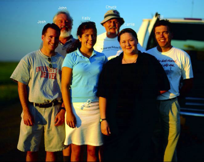
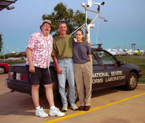
Acknowlegments: I continue to enjoy visiting NWS offices and appreciate the courtesy and hospitality shown by my friends at HSI, LBB, AMA, DDC, FSD,.and LBF. We travelled several days with our friend, John Monteverdi, which was great, as were the few days spent chasing with Brian Curran and Ed Calianese. And Steve Hodanish shared one wild day with us, which we thoroughly enjoyed, as well. Chasing with Bill Reid was great fun. Thanks to Bobby Eddins for the video panoramic software and for allowing me to reproduce his great images!
These have been updated and consolidated into a single new page, here.