Additions to:
Microbursts
A Handbook for Visual Identification
Fernando
Caracena,
NOAA/Forecast
Systems Lab*
Ronald L.
Holle, NOAA/National Severe
Storms Lab*
_____________
* Affiliations at the time of publication - All now retired from NOAA
NOTES
The following are additions to the
Microburst
Handbook page. Items are being added here in order to limit the
loading time for the Handbook proper. These are new topics and/or new
images that we believe add to the objectives of the Handbook: helping
people identify microbursts and downbursts visually.
Unless otherwise noted, all images are copyrighted. Permission
to use them in any form must be obtained from the authors, to avoid
the need for messy copyright infringement litigation.
_____________
Most recent update: 09 February 2011: Moved to my home web page and updated
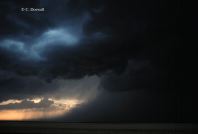
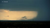
(24 November 1997; Chuck Doswell): I've scanned some more
images that might be of interest or value. [All images ©1997
C. Doswell]
- The
 first
image is an example of some virga showers falling from a
relatively high-based, shallow cloud near Balmorhea, Texas on 18
May 1985. This sort of weak shower with virga, perhaps occurring
without any lightning (or thunder), is often associated with "dry"
microbursts. There may be some light rain with it, however (see
the next discussion).
first
image is an example of some virga showers falling from a
relatively high-based, shallow cloud near Balmorhea, Texas on 18
May 1985. This sort of weak shower with virga, perhaps occurring
without any lightning (or thunder), is often associated with "dry"
microbursts. There may be some light rain with it, however (see
the next discussion).
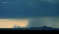
- The
 second
image is another example of virga, this time from a high-based
cloud near the town of Blanding, Utah on 28 May 1993. Current
scientific thinking is that virga is associated with snow or
graupel (snow pellets) ... when it melts, it falls much more
rapidly and is no longer as visible. This image certainly seems to
support such a hypothesis. Thus, beneath a virga shaft, there may
well be rain reaching the surface, although it certainly does not
appear that way from a distance. Virga always suggests a
possibility of microbursts.
second
image is another example of virga, this time from a high-based
cloud near the town of Blanding, Utah on 28 May 1993. Current
scientific thinking is that virga is associated with snow or
graupel (snow pellets) ... when it melts, it falls much more
rapidly and is no longer as visible. This image certainly seems to
support such a hypothesis. Thus, beneath a virga shaft, there may
well be rain reaching the surface, although it certainly does not
appear that way from a distance. Virga always suggests a
possibility of microbursts.
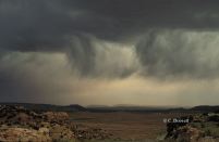
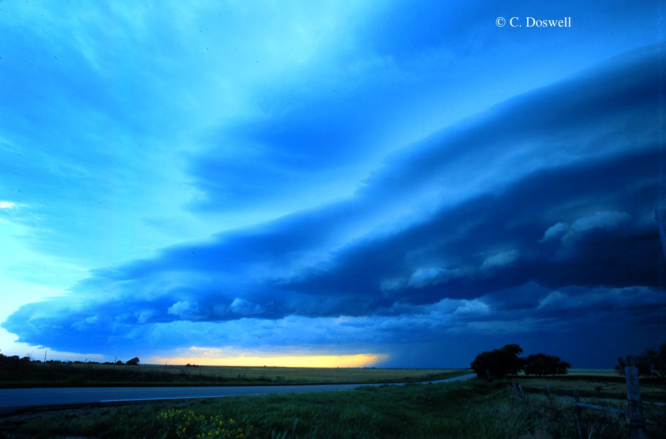
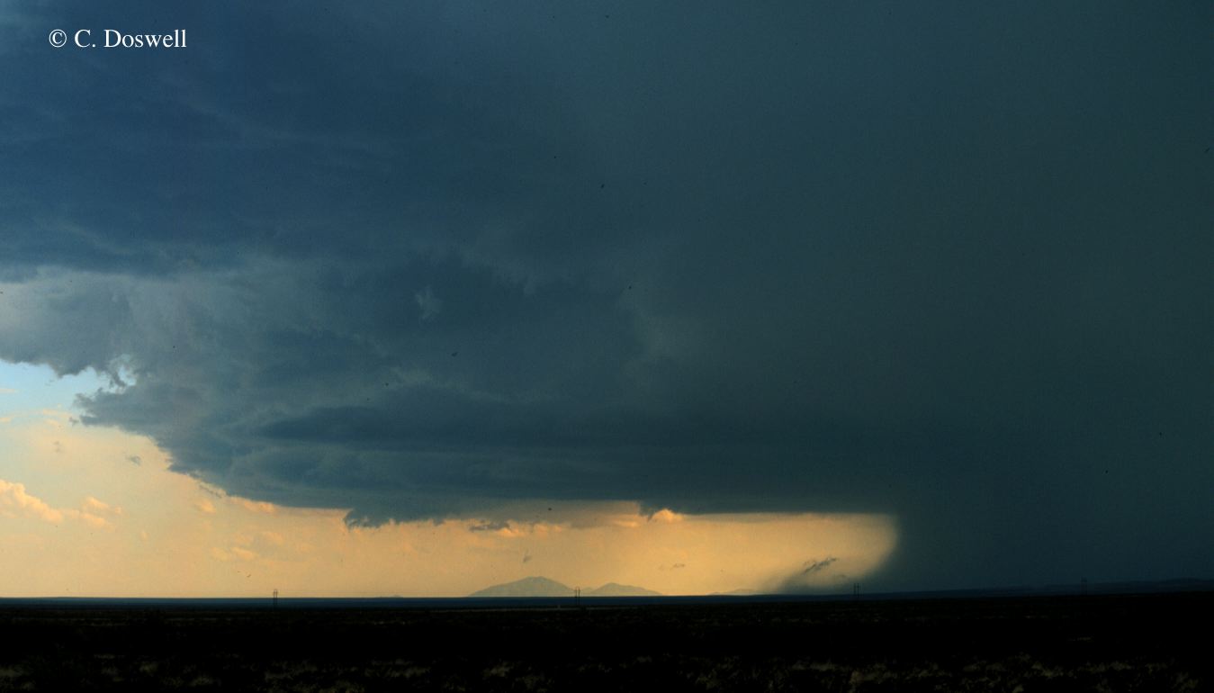
- The
 third
image is an example of a dramatic stacked "shelf" cloud at the
leading edge of a gust front. In this example on 15 June 1997 in
northwestern Oklahoma, the gust front was moving rapidly (about 20
m s-1, or 40 kt) away from the precipitation cascade
(lower right) that was producing the outflow. At times, new
thunderstorms will develop along this leading gust front, and the
older storms will be cut off from their supply of warm, moist
inflow by their own outflow.
third
image is an example of a dramatic stacked "shelf" cloud at the
leading edge of a gust front. In this example on 15 June 1997 in
northwestern Oklahoma, the gust front was moving rapidly (about 20
m s-1, or 40 kt) away from the precipitation cascade
(lower right) that was producing the outflow. At times, new
thunderstorms will develop along this leading gust front, and the
older storms will be cut off from their supply of warm, moist
inflow by their own outflow.
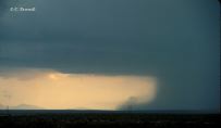
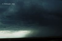
- The
 fourth
image is a dramatic example of a "rain foot" ... a rapid
transition from downdraft to outflow produces an outward-flaring
precipitation cascade, pushing rain outward near the surface and
indicating very strong outflow. This case occurred in western
Oklahoma on 2 June 1985.
fourth
image is a dramatic example of a "rain foot" ... a rapid
transition from downdraft to outflow produces an outward-flaring
precipitation cascade, pushing rain outward near the surface and
indicating very strong outflow. This case occurred in western
Oklahoma on 2 June 1985.
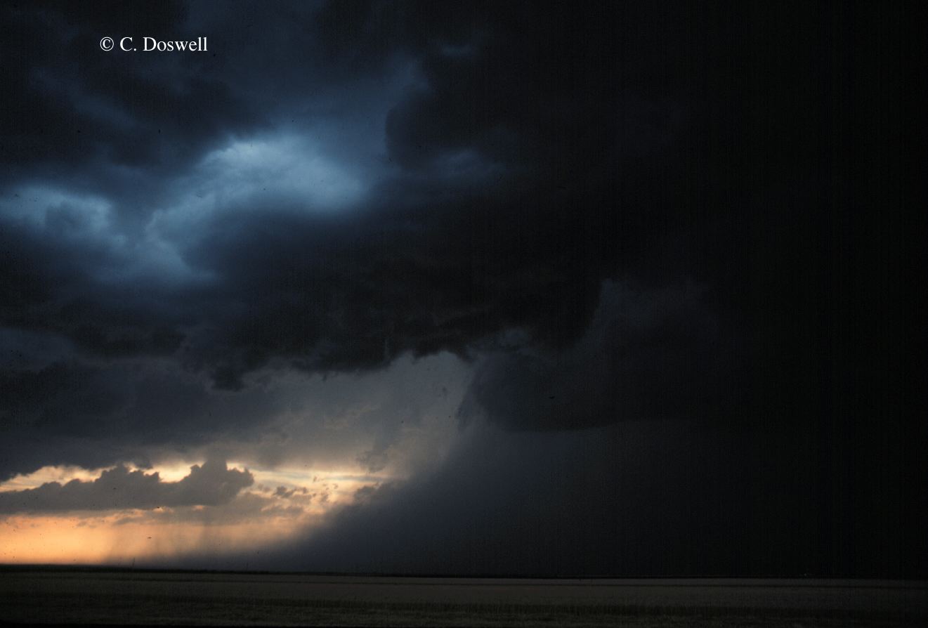
- The fifth and final example is a series of four images,
the
 first
shows another example of a "rain foot" where the cold ouflow is
producing "scud" clouds at its leading edge. The
first
shows another example of a "rain foot" where the cold ouflow is
producing "scud" clouds at its leading edge. The
 second
is about 20 min later, and a new surge of outflow has produced
another rain foot, that shows some tendency to curl over at its
leading edge. The
second
is about 20 min later, and a new surge of outflow has produced
another rain foot, that shows some tendency to curl over at its
leading edge. The
 third is
a few min later, showing a somewhat wider view of the storm ...
the rain foot shows some scud clouds that have formed on the
curled-back portion of the leading edge. The
third is
a few min later, showing a somewhat wider view of the storm ...
the rain foot shows some scud clouds that have formed on the
curled-back portion of the leading edge. The
 final
shot is again a few min later, where the outflow seems to have
slowed down a little, and scud continues to form. Based on the
appearance of the rain foot, it appears that another surge of
outflow is beginning. This storm occurred on 7 June 1997,
southwest of Guadalupe National Park, and produced several surges
of outflow, eventually spawning a
tornado
over the Sierra Diablo Mountains, as well as numerous microbursts.
Virtually all of this activity was over open country.
final
shot is again a few min later, where the outflow seems to have
slowed down a little, and scud continues to form. Based on the
appearance of the rain foot, it appears that another surge of
outflow is beginning. This storm occurred on 7 June 1997,
southwest of Guadalupe National Park, and produced several surges
of outflow, eventually spawning a
tornado
over the Sierra Diablo Mountains, as well as numerous microbursts.
Virtually all of this activity was over open country.
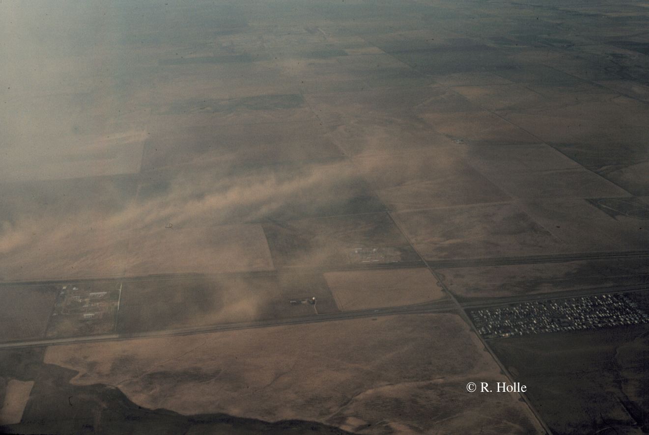
(24 November 1997; Ron Holle) A series of 4 photos shows a
microburst near Stapleton International Airport on 23 August 1990
between 1905 and 1909 MDT. These views were taken during the approach
to the airport on a commercial airliner; the plane was diverted
around the event. Dust is blowing across fields at speeds estimated
to be in excess of 50 knots. Rainbow segments are visible when the
sun illuminates raindrops to the east of the aircraft. [Photos ©
1990 by Ronald L. Holle]
(11 December 1997):
Ron Holle: A
 rain foot
at 1737 Central Daylight time evolved into this
rain foot
at 1737 Central Daylight time evolved into this
 downburst
five minutes later, at 1742. Winds are blowing outward from the storm
on the right; dust is being raised as winds blow over an open field.
The event occurred near Boise City, Oklahoma on 15 July 1992. Photos
©1992 Ronald L. Holle.
downburst
five minutes later, at 1742. Winds are blowing outward from the storm
on the right; dust is being raised as winds blow over an open field.
The event occurred near Boise City, Oklahoma on 15 July 1992. Photos
©1992 Ronald L. Holle.
Bill Bunting: A microburst descends from the parent cloud
to the ground and begins to spread out, in this sequence of four
photos from central Oklahoma on 24 October 1991. The outward flow of
winds is apparent at the ground in the last view. Photos ©1991
William Bunting.
Chuck Doswell: This
 downburst
occurred on 27 May 1988, near Bushland, Texas. The outflow from right
to left is curling over, lifting dust at its leading edge. Photo
©1997 C. Doswell.
downburst
occurred on 27 May 1988, near Bushland, Texas. The outflow from right
to left is curling over, lifting dust at its leading edge. Photo
©1997 C. Doswell.
return to the
Microburst
Handbook Page
return to the
Semi-Official
Microburst Handbook Home Page
 first
image is an example of some virga showers falling from a
relatively high-based, shallow cloud near Balmorhea, Texas on 18
May 1985. This sort of weak shower with virga, perhaps occurring
without any lightning (or thunder), is often associated with "dry"
microbursts. There may be some light rain with it, however (see
the next discussion).
first
image is an example of some virga showers falling from a
relatively high-based, shallow cloud near Balmorhea, Texas on 18
May 1985. This sort of weak shower with virga, perhaps occurring
without any lightning (or thunder), is often associated with "dry"
microbursts. There may be some light rain with it, however (see
the next discussion).
 second
image is another example of virga, this time from a high-based
cloud near the town of Blanding, Utah on 28 May 1993. Current
scientific thinking is that virga is associated with snow or
graupel (snow pellets) ... when it melts, it falls much more
rapidly and is no longer as visible. This image certainly seems to
support such a hypothesis. Thus, beneath a virga shaft, there may
well be rain reaching the surface, although it certainly does not
appear that way from a distance. Virga always suggests a
possibility of microbursts.
second
image is another example of virga, this time from a high-based
cloud near the town of Blanding, Utah on 28 May 1993. Current
scientific thinking is that virga is associated with snow or
graupel (snow pellets) ... when it melts, it falls much more
rapidly and is no longer as visible. This image certainly seems to
support such a hypothesis. Thus, beneath a virga shaft, there may
well be rain reaching the surface, although it certainly does not
appear that way from a distance. Virga always suggests a
possibility of microbursts.
 third
image is an example of a dramatic stacked "shelf" cloud at the
leading edge of a gust front. In this example on 15 June 1997 in
northwestern Oklahoma, the gust front was moving rapidly (about 20
m s-1, or 40 kt) away from the precipitation cascade
(lower right) that was producing the outflow. At times, new
thunderstorms will develop along this leading gust front, and the
older storms will be cut off from their supply of warm, moist
inflow by their own outflow.
third
image is an example of a dramatic stacked "shelf" cloud at the
leading edge of a gust front. In this example on 15 June 1997 in
northwestern Oklahoma, the gust front was moving rapidly (about 20
m s-1, or 40 kt) away from the precipitation cascade
(lower right) that was producing the outflow. At times, new
thunderstorms will develop along this leading gust front, and the
older storms will be cut off from their supply of warm, moist
inflow by their own outflow.
 fourth
image is a dramatic example of a "rain foot" ... a rapid
transition from downdraft to outflow produces an outward-flaring
precipitation cascade, pushing rain outward near the surface and
indicating very strong outflow. This case occurred in western
Oklahoma on 2 June 1985.
fourth
image is a dramatic example of a "rain foot" ... a rapid
transition from downdraft to outflow produces an outward-flaring
precipitation cascade, pushing rain outward near the surface and
indicating very strong outflow. This case occurred in western
Oklahoma on 2 June 1985.
 first
shows another example of a "rain foot" where the cold ouflow is
producing "scud" clouds at its leading edge. The
first
shows another example of a "rain foot" where the cold ouflow is
producing "scud" clouds at its leading edge. The
 second
is about 20 min later, and a new surge of outflow has produced
another rain foot, that shows some tendency to curl over at its
leading edge. The
second
is about 20 min later, and a new surge of outflow has produced
another rain foot, that shows some tendency to curl over at its
leading edge. The
 third is
a few min later, showing a somewhat wider view of the storm ...
the rain foot shows some scud clouds that have formed on the
curled-back portion of the leading edge. The
third is
a few min later, showing a somewhat wider view of the storm ...
the rain foot shows some scud clouds that have formed on the
curled-back portion of the leading edge. The
 final
shot is again a few min later, where the outflow seems to have
slowed down a little, and scud continues to form. Based on the
appearance of the rain foot, it appears that another surge of
outflow is beginning. This storm occurred on 7 June 1997,
southwest of Guadalupe National Park, and produced several surges
of outflow, eventually spawning a
tornado
over the Sierra Diablo Mountains, as well as numerous microbursts.
Virtually all of this activity was over open country.
final
shot is again a few min later, where the outflow seems to have
slowed down a little, and scud continues to form. Based on the
appearance of the rain foot, it appears that another surge of
outflow is beginning. This storm occurred on 7 June 1997,
southwest of Guadalupe National Park, and produced several surges
of outflow, eventually spawning a
tornado
over the Sierra Diablo Mountains, as well as numerous microbursts.
Virtually all of this activity was over open country.
 Number 1
 Number 2
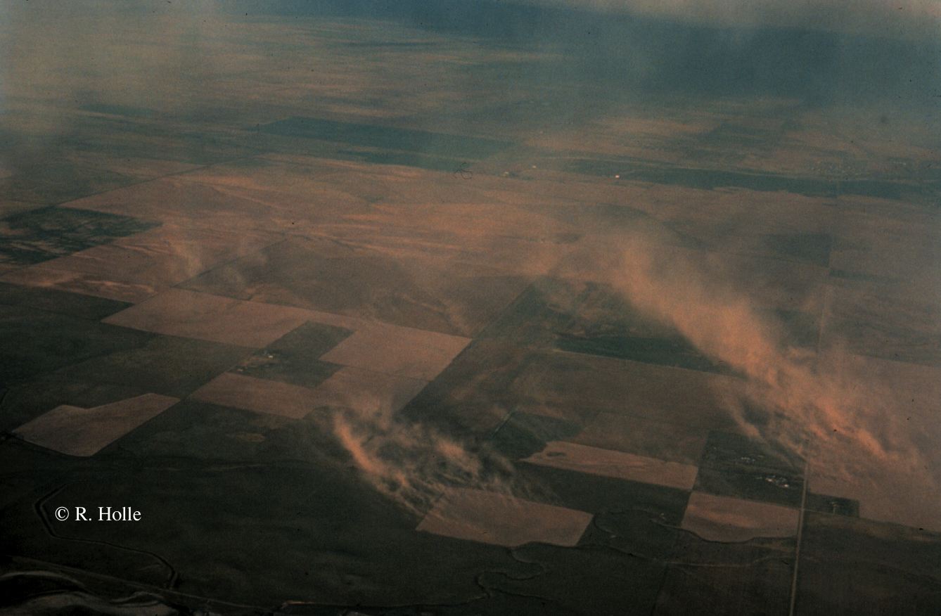 Number 3
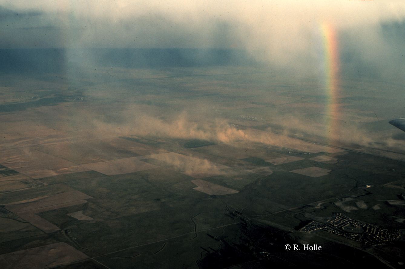 Number 4
 rain foot
 downburst
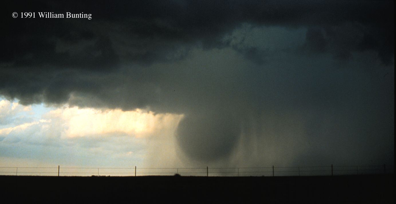 Number 1
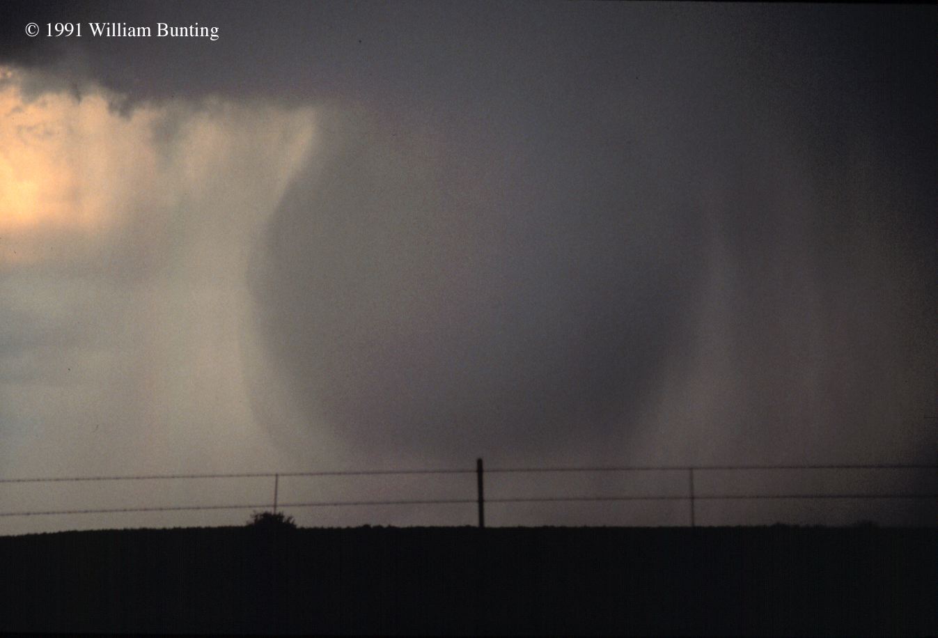 Number 2
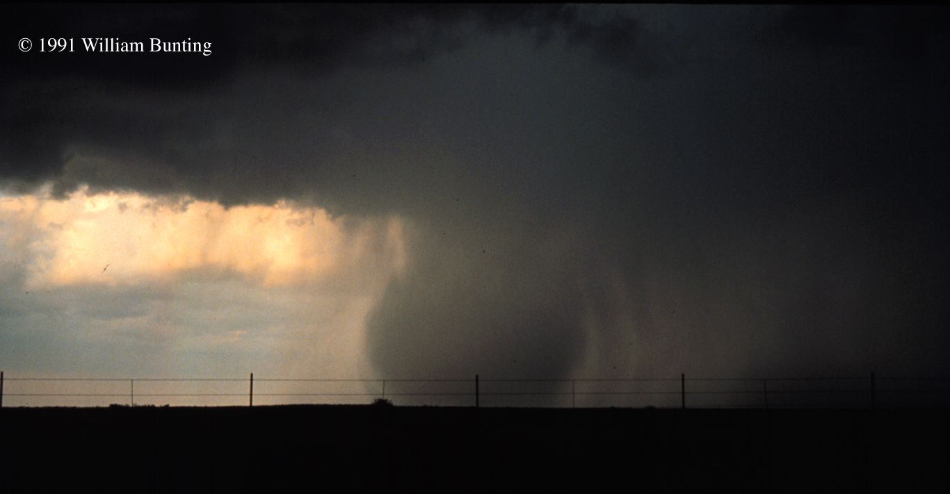 Number 3
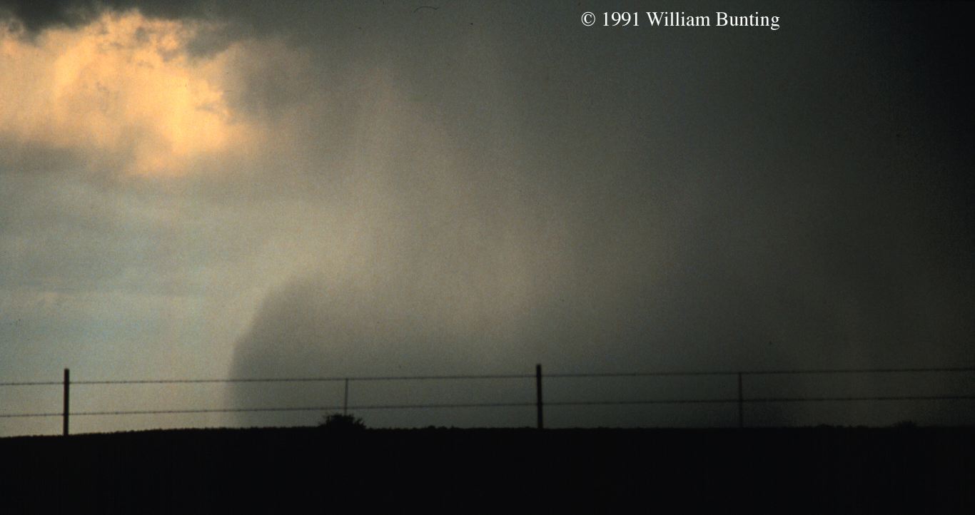 Number 4
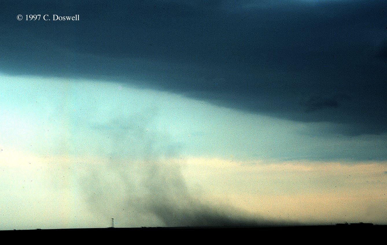 downburst