As usual, the images in this are copyrighted. Please respect that. If you're aware of any mistakes that might have crept into these accounts because of my faulty memory, or have anything else you want to comment about, you can e-mail me at: cdoswell@earthlink.net
This is a short history of my involvement with storm chasing. I don't know of any specific incident that caused me to be so passionate about storms. Perhaps it began with simple curiosity, driven by seeing pictures of tornadoes in various places. There were the odd newspaper and magazine tornado photographs after outbreaks, and the photos in encyclopedias (the "T" volume was always the first one I went to!), and so on. I know the photographs aroused my curiosity!
Once incident stands out in my mind, but I don't recall the date. We had a major storm move through my hometown, Villa Park, in the Chicago Suburbs in the spring/summer of 1957. Through the trees, I could look up and see a small portion of sky, and on that day I observed various swirling motions in what I know now to be the "vaulted" region behind a gust front (also referred to as the "whale's mouth" ). Then, we were hit by hail - and, as I recall, the stones were about ping-pong ball sized - around one inch or so in diameter. Then we had major flooding rains that flooded our street - and our basement. Finally, the power went out for a while, so we ate our supper by kerosene lamplight. I thought it was all pretty great stuff. I was 11 years old at the time, in 6th grade. I don't think that event was what made up my mind - I was already pretty excited about storms and this one was terrific. But it didn't establish my interest. It only reinforced what was already there. Other kids ran into their houses when storms approached - I ran out to watch them
I spent most of my summers up to my teenage years on the farm belonging to my aunt and uncle in western Illinois, near Galesburg. I can recall being really excited by the nocturnal thunderstorms we often experienced. They'd blow through mostly after midnight - and wake us up with lightning, thunder, wind, and rain. I liked that. Curiously, in all the years my uncle farmed the land, he was never hailed out and never hit by a tornado. I remember seeing an evening thunderstorm one night in the distance, lit up on the inside with nearly continuous in-cloud lightning. That was a really fascinating sight and my cousin and I watched it for quite a while.
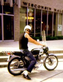
The Chicago suburbs aren't exactly great chase country. I remember one afternoon in my late high school days, after I got my driver's license, driving a few miles from home to get a better view of an incoming storm. As I recall, I wound up on my high school campus, as that was a place with a relatively open space. I didn't see anything very good, though. Just another funky Illinois squall line.
My goal was to see a tornado and find out what was going on before the tornado, and what a tornadic storm looked like. Most tornado photographs zoomed in on the tornado but I wanted to see more of what the storm looked like, in space and time. As mentioned, I knew by the time I was getting out of elementary school what I wanted to be - a meteorologist, studying tornadoes! During HS in my senior year, I actually visited Prof. Fujita's lab at the University of Chicago on some field trip for students. I don't recall meeting the man, though. I graduated from HS in the spring of 1963, at age 17.
When I went to Wisconsin for undergraduate school, I loved the Meteorology courses, but was not yet a good enough student to know to pay attention to the whole curriculum. Madison isn't a great place to see the sky (too many trees and buildings, like Chicago) and the storms typically weren't all that great either - it seemed that good storms stayed well away from Madison. There were only a few stormy days that stand out in my mind, and they always involved squall lines. I seemed to know already that a squall line just was not what I was looking for, in spite of what some textbooks were saying at the time. During my time in Wisconsin, a major tornado outbreak on 21 April 1967 hit the northern Chicago suburbs, so naturally I was in the wrong place at the right time! I made no attempts to chase while I was a student in Madison, except maybe to try to get a better view of thunderstorms on foot, by going out near the shores of Lake Mendota.
My last two years at Madison, I worked the summers as a student trainee as the Weather Bureau Airport Station in Madison. Great experience, but not very enlightening regarding storms.
After I graduated in 1967, at the urging of Dave Barber, then a grad student at Wisconsin, I applied for and got a student trainee job at SELS, in Kansas City, MO. What an absolute dream summer job! Again, Kansas City clearly was not a mecca for great storms, and nothing much happened there during my summers as a trainee - I spent two and a half summers there in total.
I began grad school at Oklahoma in the fall of 1967, still burning to see a tornado. Make no bones about it, I already knew that Oklahoma was supposed to be associated with tornadoes and that was a definite factor in my choosing to go there. In the following two years, though, I only made a few tentative chases after storms. I had no idea what I was doing, and was only willing to go a few miles in any direction. I did this very limited "chasing" a handful of times in those two years, with essentially no results. I did manage to become very motivated about my graduate studies, though. I finished my M.S. in three semesters, graduating in December of 1968, and then began my Ph.D. program the following spring.
I returned to Kansas City for a 3rd summer in SELS as a student trainee, but then received my draft notice. I was in the Army!! That's a whole story in itself.
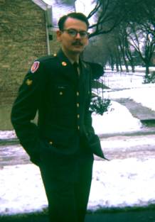
After my tour in Viet Nam, I went on to spend more than a year at White Sands Missile Range in New Mexico, working in the Atmospheric Sciences Laboratory there, and mostly living in Las Cruces.
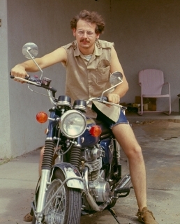
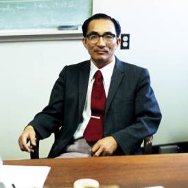
Upon separating from active military duty in February of 1972, I returned to Norman to continue my graduate studies. That spring, it happened that I found myself in the midst of a whole group of storm freak students! The dynamics of that group reinforced the largely suppressed interest we all seemed to share for storms and tornadoes. Where chasing had seemed like a crazy idea, suddenly I was going to school with a bunch of people who all shared a similar interest. Chasing didn't seem like such a crazy idea, after all, at least in this company. With my advisor's (Prof. Yoshikazu Sasaki) blessing, I was allowed to join the chase crew that was being formed at NSSL.
At that time, Joe Golden was finishing his Ph.D. studies while working at NSSL, and he'd been "chasing" waterspouts in Florida for a number of years, mostly from aircraft. A formal scientific storm chase program led by Joe and a Notre Dame professor named Bruce Morgan (who had actually proposed chasing tornadoes in a tank!) had been developed and NSSL was prepared to provide some support in the form of chase vans. Many of the established scientists at NSSL and OU were pretty skeptical about this notion of storm chasing, but we students enthusiastically volunteered to participate. My advisor, Prof. Sasaki, was not only willing to let his students participate in this formal chase program, but he even provided us with a 16 mm Bolex camera.
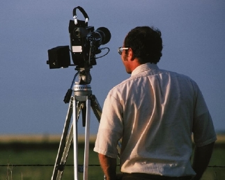
The goal of the project, the Tornado Intercept Project (or TIP), was to obtain high-quality movies of a tornado's debris cloud in order to do photogrammetric windspeed analysis. The idea was to document the actual windspeeds in tornadoes, to see if we could put some limits on the absolute peak windspeed associated with a tornado. A lot of ideas were about that we now consider silly, such as windspeeds exceeding the speed of sound, so our task was to get in close and film debris clouds! Perfect.
Except that none of us had the slightest clue how to go about chasing storms with an eye to get close to a tornado. There was virtually no information about chasing available, so we had only on-the-job training. Many of us had read Fujita's 1960 report about the June 27 tornadoes near Fargo, ND. In fact, I had cut some pictures of the Fargo storm out of Life magazine from that summer of 1957 - I still have them. And Prof. Fujita had sent me an informal Tech. Report on the event when I was an undergrad student at Wisconsin. [This treasured report was subsequently stolen from my office by some low-life slimeball in Boulder! Unreal!]. We'd also read the photogrammetric analysis paper by Walter H. Hoecker that analyzed the film from the 2 April 1957 Dallas, TX, tornado. All of us had consumed voraciously the work produced by Keith Browning based on the 26 May 1963 outbreak in Oklahoma. Finally, we had read the papers by Fred Bates on his tornado observations. That was about it when it came to having an understanding of what we were about to do. There just wasn't much out there for us to go on in trying to develop strategy and tactics for storm chasing.
My first chase with TIP was on 18 April 1972. We chased a nontornadic storm into northwestern OK and southwestern KS. I have no photographs, unfortunately, but it was a beautiful storm. Here I was, a kid from the Midwest who always had to deal with trees, and buildings, and poor visibility in general. On this chase, we had a magnificent view of the storm. At one point, we drove right up to the edge of the updraft. I got out of the van, tilted my head back and was flabbergasted to look up an absolutely vertical cumulonimbus tower wall rising to meet the anvil of the storm. I was open-mouthed, in part because of the need to tilt my head back, and in part from outright excited astonishment. I tried to comprehend what my mind was telling me - this vertical wall was something like 40 to 50 thousand feet tall! From that point, I was hooked!! We got home late, and I had much school work to do that night and the next day.
Despite that, I chased on the morning of 19 April, and in our ignorance, we foolishly went after the morning convection on a serious storm day (almost always a bad choice!). Needless to say, we chased a funky squall line south and saw nothing even remotely interesting. I came back with academic obligations staring me in the face, so when chasers of all sorts went out that afternoon, I stayed on campus, trying to be a good student. Except that when storms went up to the north (where the NSSL team went) and to the southwest (where my friend Al Moller went), I spent that afternoon and evening going crazy watching the weather from a distance. Late in the day, a left-mover that had split off a storm to our southwest roared across central Oklahoma to the near west of Norman, dropping large hail. My friend Al and his companions, on TIP-associated student chase, nearly drove into the dissipating stages of a deadly tornado that had hit near Davis, OK, while they were driving south on I-35. All in all, it was a bad day to have stayed home!! Not the last time I made such a choice, however.
A few days later, we were at it again, this time in north Texas, west of I-35 -- I don't recall the date. We wound up having to punch through a storm from the west, with prodigious rainfall. When we did so, we saw a lowered, rotating base that appeared to be a wall cloud. It produced some funnels near St. Jo, TX, but no tornado. I 'd been chasing only for a few days, but I was getting discouraged. It seemed like I would never see a tornado, after all.
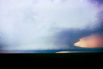
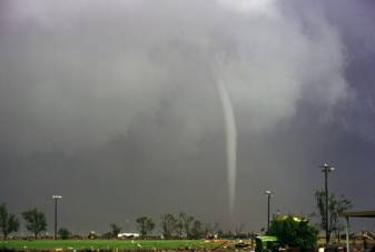
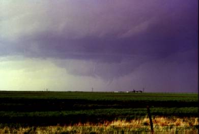
1972 was not a banner year for storms in the region. I don't recall any further chases until 30 April. On that day, we (I was again with the NSSL TIP team, including Steve Tegtmeier as one of my fellow student participants) headed west on I-40 with nowcasting support via the radio telephone from Don Burgess back at NSSL. As we got into western OK, he suggested we drop south after a storm that was looking interesting on radar. We drove through the anvil precipitation and even encountered some hail, but then we broke out and got a view of the storm. Wow! I had never seen a supercell before, but this storm was clearly something special. Joe Golden was suggesting we move on, but I insisted we had to stay put, because this storm was going to do it - a few minutes later, it did! The tornado funnel didn't reach all the way to the surface, but there was a debris cloud. I captured the whole tornado event on the Bolex camera and took a few slides with my still camera -- far too few by today’s standards. I'd seen my first tornado!! A report of our 1972 chase activities was published in the Bulletin of the American Meteorological Society by Golden and Morgan.

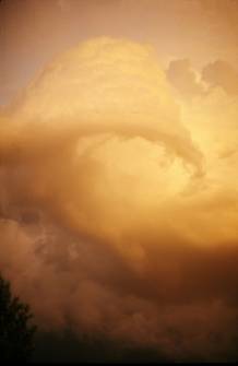
I missed several more exciting chase days, including 22 May that year, which produced a tornado near Cordell, OK after sunset. I had academic obligations, unfortunately. But 1972 had one more event in store -- 27 June. That afternoon, we chased a storm privately (not part of TIP) that came close to producing a tornado (a rotating wall cloud with a funnel cloud or two) near the eastern parts of OKC, but then that storm died suddenly. I had been invited to a party that night, so we gave up and went back to Norman. While I was at the party, we engaged in some typical student behavior of the times, and as a result, my thinking was somewhat impaired when it began to storm outside. In fact, hail began to fall, up to about hen's-egg size. When the storm passed, I stepped outside to see a magnificent storm illuminated in yellow evening light. Then we saw a strange rotating cloud that passed to our east, going from south to north. I was able to get some photographs of that rotating feature. Steve Tegtmeier also saw and photographed it from a different angle and we subsequently submitted a report of our observations to the Bulletin of the American Meteorological Society -- essentially, this was my first sort-of scientific publication. This cyclonically rotating feature was on the tail end of a flanking line associated with a left-moving supercell. I've since seen other examples -- it's more or less a "bookend" vortex on the cyclonic shear side of the RFD outflow, but the phenomenon has never been studied scientifically. It was not remotely tornadic, but fascinating to watch.
The storms were wildly electrified and produced a spectacular lightning show to our east that night.
That wraps up 1972 -- but leads to the fantastic chase year of 1973. Steve Tegtmeier and I started chasing again on 1 March of 1973. We chased a storm to somewhere near Chickasha, and saw a rotating wall cloud with a funnel at least halfway to the ground, but we had made a navigation mistake and the storm rolled over us, dumping a lot of pea-sized hail and basically ending our chase. Nevertheless, it was an auspicious start.
On 13 March, we chased on a day when the convection in Oklahome rapidly became an extremely fast-moving squall line. We went out to the southwest to meet it, but it roared past us at about 60 mph, utterly unchaseable and surely unchaseworthy. We had about 3 minutes of intense rain as the line raced past us, and then it was over. It slowed down in Arkansas, after leaving us in its wake, having nothing to do but go back to Norman -- and produced tornadoes there, as well as in Kansas, but nothing chaseable for us in Oklahoma, unfortunately.
On 14 April, Steve, John McGinley and I chased all the way into the Texas Panhandle. At the time, this seemed outrageously audacious and an incredibly long way to go to see a storm. Norman was in cold drizzle and most of our fellow student chasers felt we were going on a fool's errand. We drove in low clouds and drizzle to well into the Panhandle. But we had a radio going and began to hear reports of a large tornado somewhere in the vicinity of Amarillo. We wound up in open country somewhere east of Amarillo, with a tremendous storm (that I would now describe as an HP supercell) in view. I took time lapse movies of the storm with the Bolex movie camera (much of what I shot with that camera has been lost, unfortunately!) and managed to get a few slides, as well. It was a beautiful storm, moving slowly and a thoroughly satisfactory chase. We got home late, but happy, and proud of the gamble we took when it seemed like such a big deal to drive "all the way to the Texas Panhandle" -- a distance that soon became commonplace for us.
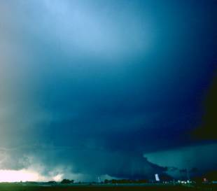
An obvious standout day of 1973 was 24 May -- the so-called Union City (UC) tornado. I chased with John McGinley, Al Moller, and Randy Zipser, in McGinley's car (a Mustang, so we were cramped). We took off toward the slowly approaching cold front where we thought the action would be. Along the way, we drove right through Union City, where I was upset because we couldn't find a phone there. There was a storm developing to the west that we thought looked very interesting, but without further information, we pushed on past it toward our target area. Finally, we got up near Geary (I think), found a phone and called back to Don Burgess at NSSL, who said we needed to get our butts back to the storm we'd left behind, which we proceeded to do. We were headed east on I-40 on the north side of the developing storm and could see a wall cloud and even some hints of funnels. Unfortunately, we were on the wrong side of it, and would have to "core punch" to get to the action area. In the meantime, we stopped on I-40 and watched some funnel clouds for a few minutes. After that, we turned southward into the precip from the UC storm, eventually encountering some hail -- as we emerged from that rain and hail, the tornado gradually appeared. It had already traversed most of the city, and eventually we drove into the north side of the damage path. I took a few slides (far too few, as usual, by today's standards), but we were stunned by what had happened to Union City. The storm produced no more tornadoes and merged into a squall line after that. Our friend, Steve Tegtmeier and his wife had not chased with us, having a leisurely lunch and then driving out to the west -- they had a front row seat for the whole tornado, and took what probably are the best images of the storm. The NSSL team was also on the proper side of the storm, but most of their images were from behind a railroad embankment, so the lower part of the funnel and debris cloud were not visible. This storm went on to become famous for its scientific value, since it had been at relatively close range to the NSSL Doppler radar and been intercepted by multiple teams, including ours. We went on a storm damage survey the following day -- I was involved with surveying the path west of town, where a farm home had been completely swept away.
I didn't chase the event two days later (26 May), as I had academic obligations. There were tornadic storms up near Wichita, KS (chased by my friend, Gordon Gerber, who got some sensational 8 mm movies of the storm and tornado), and also near Keefton, OK.
On 4 June, Al Moller and I chased storms first to the northwest of Norman, seeing a spectacular nontornadic supercell.
We then drifted south with the storms and saw a number of small storms merging with the big one. One of them produced a brief tornado during the merger near NSSL but we were way out of position to the west and never saw it. Don Burgess shot a tornado image from NSSL!
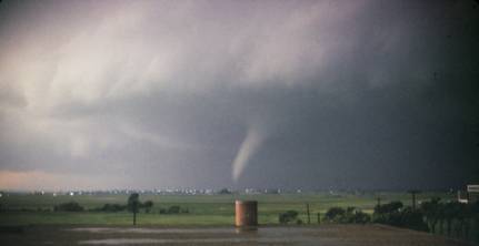
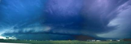
My chasing in 1973 was topped off on 18 June. We had a classic subsynoptic low with a triple point off to the southwest and a very unstable, but capped airmass. We were unsure if anything at all would go, so we hung around the OU Meteorology Department for quite a while. Back then, we had access to the roof of the OU Physical Plant building, so we could go up there for a better view. Sometime after 3 pm, we went up there and saw tremendous towering Cu exploding to the west-southwest -- the chase was on! On this day, I was chasing with Al Moller (in his red 1967 Pontiac GTO, no less) and Gene Moore. As we approached the developing storm, we could see it had two wall clouds, and a tremendous rain-free base. Eventually, it seemed as if the wall clouds were producing precipitation and new wall clouds were forming to their south. The storm was slow-moving and as we drew closer, one of what we thought were precip shafts turned out to be a large stovepipe tornado directly to our west. We stopped several miles to the east of the tornado and I used the Bolex 16 mm camera to record the event (film that also has been lost). I shot a few slides of the event (too few, of course). Steve Tegtmeier also chased the storm and was only a short distance ahead of us. After the large tornado dissipated, we saw another tornado to our southwest. This one was mostly transparent from our viewing angle, only visible as a translucent dust sheath by which we could make it out (see Gene Moore's account here). Some farmer sent us his photos later, which revealed the funnel with much better definition. His tornado photos could have been of a different tornado from the one we saw. This tornado induced us to try to drop south to catch more tornadoes. Unfortunately, along the way, we encountered a wet patch of highway after cresting a hill and hydroplaned, eventually coming to a stop (after considerable swerving from one side of the road to the other) in the opposite lane, headed the opposite way from where we started. This unnerved us, so we put our tails between our legs and went back home, thoroughly drained from a chase day that had been more exciting than we wanted. It turned out there were additional tornadoes farther to our southwest, just north of the Red River, near Frederick, OK. We might or might not have been able to get there in time. The following day, we did another damage survey, that included hearing some tall tales by the locals.
This case turned out to be the primary case in my dissertation study, so it will always be a special event for me.
1974 was not a banner year for me. The day before the 3 April 1974 Superoutbreak, the dryline blew through Oklahoma without much moisture ahead of it. We had anticipated a big day the next day, and it turned out to be the biggest outbreak in U.S. history! Too far away and fast-moving to even consider chasing, though.
We (Al Moller, Phil Pasteris and others I don't recall) chased into the Texas Panhandle on 19 April. Three simultaneous tornadoes rewarded us, but my photos were worthless, having been shot with a wide angle. Phil Pateris caught two of the three with this shot, but the third was too far away and hard to see to capture.
On 20 April, we (including Al Moller plue Joe Golden and the rest of the NSSL team) intercepted a storm near Carnegie, OK and had some interesting adventures making a phone call back to NSSL from a local bar. But we missed the tornadoes the storm produced closer to Oklahoma city.

We didn't believe the tornado reports when we heard of them later, because we didn't see them, but they apparently were legitimate tornadoes.
Al Moller and I chased on 27 April, toward southwestern OK. We ran into what amounted to a nontornadic squall line, but a new storm developed along the outflow boundary laid down by the first line, and it became a supercell, with a spectacular tail cloud.
The rapid motion from right to left along the tail cloud was very dramatic. It was comparable to the Fargo storm of 1957 in our minds, without the tornado, unfortunately. The time lapse footage I shot of this storm has also been also lost, unfortunately. This storm produced some funnels after sunset, but no tornadoes that we saw. A good chase day, despite not seeing any tornadoes.
On 20 May, Al and I chased into the Texas Panhandle. We found a supercell as the end of a gust front laid down by an earlier storm. It's possible there were some brief tornadoes, but limited road options kept us from getting close enough to be sure.
Then, on 23 May, Les Lemon back at NSSL was very excited about the storm that developed, as he saw it on radar, since it had a large, dramatic hook echo. What we found visually was what we now recognize as an HP supercell, with a beaver's tail inflow band, on the west side of the metroplex.
A TIP chase team, with Joe Golden and Dan Purcell, was just ahead of us as we raced southward just in front of the storm, but then they inexplicably turned west, right into this beast, and encountered large hail. We wanted no part of that, so we stayed headed south, ahead of and out of the storm!
On 8 June, Al Moller, Steve Tegtmeier, and I chased what was an anomalously strong trough for so late in the season. Unfortunately, we managed to see very little except the developing storms, missing the early tornadoes on the west side of Oklahoma City, and struggling with the city traffic. We chose to chase eastward on US66, which turned out to be a big mistake! We ran into flooded highway from earlier storms, and had to turn back, away from an ongoing tornado (the "Luther" tornado that was near the Interstate). Turning away from an ongoing tornado is a bad feeling!! We finally headed east on I-40, but we were too late and basically missed most of everything, except the tornado we had to turn our backs to on US66. An altogether messed-up day for us.
On 11 June, I was taking an afternoon nap in my apartment, when Al Moller phoned me, waking me up, and said : "Look out your door!" So I did and responded "Holy S__t!" Storms were exploding just south of Norman! We met at the OU Meteorology Department and chased the storms, but no tornadoes resulted. The storms did produce large hail, though.
See here for some other old chase materials.
Doswell, C.A. III, and S.A. Tegtmeier (1973): Rotating clouds at Norman, Oklahoma. Bull. Amer. Meteor. Soc., 53, 1180